Toggle navigation
LMEC Home
Exhibitions
Georeferencing
Tools for Teachers
Collections
My Favorites
Sign Up / Log In
Search
Search the map portal
Map Collection
Map Collection
Map Sets
Search
Search
Search for
Search In
All Fields
Creator
Title
Subject
Place
Search All Digital Collections
Advanced Search
8663 Results
My Search
Start Over
More Like
commonwealth:cj82kn950
Remove constraint More Like: commonwealth:cj82kn950
Filter your Search
Place
North and Central America
5,907
United States
4,827
Massachusetts
2,069
Europe
1,388
Suffolk (county)
1,042
Boston
1,015
Canada
455
Asia
436
more
Place
»
Topic
Boston (Mass.)--Maps
583
United States--Maps
279
Real property--Massachusetts--Boston--Maps
175
Massachusetts--Maps
162
Landowners--Massachusetts--Boston--Maps
133
New England--Maps
122
North America--Maps--Early works to 1800
103
Europe--Maps
79
more
Topic
»
Date
Date range begin
–
Date range end
Current results range from
1482
to
2023
View distribution
Creator
United States. Hydrographic Office
595
O.H. Bailey & Co
148
Des Barres, Joseph F. W. (Joseph Frederick Wallet), 1722-1824
123
United States. Post Office Dept
120
Ptolemy, 2nd cent
100
Walling, Henry Francis, 1825-1888
94
Geological Survey (U.S.)
86
Jefferys, Thomas, -1771
85
more
Creator
»
Format
Maps/Atlases
8,604
Manuscripts
215
Prints
56
Books
36
Objects/Artifacts
10
Drawings/Illustrations
8
Posters
4
Georeferenced
Yes
871
No
7,792
Collection
Norman B. Leventhal Map & Education Center Collection
8,641
Boston and New England Maps
2,225
Urban Maps
1,985
Maritime Charts and Atlases
1,083
American Revolutionary War-Era Maps
633
Boston Redevelopment Authority Collection
87
American Antiquarian Society Collection
9
William L. Clements Library Collection
6
more
Collection
»
Available to use
No known restrictions
8,499
Creative Commons license
50
Search Constraints
Sort by relevance
relevance
title
date (asc)
date (desc)
Number of results to display per page
20 per page
10
per page
20
per page
50
per page
100
per page
View results as:
grid view
map view
Search Results
3561.
Map of British Columbia and part of western Canada, showing the lines and lands of the Canadian Pacific Railway
3562.
Map of British Columbia to the 56th parallel, north latitude
3563.
Map of Brookline and vicinity
3564.
Map of Broome County, New York
3565.
Map of Burma : prepared for the Ireland report on colonial administration in the Far East
3566.
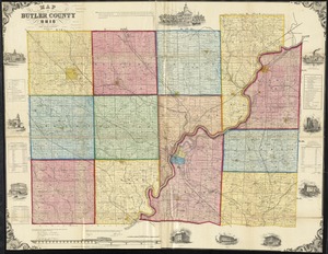
Map of Butler County, Ohio
3567.
Map of Caledonia County, Vermont
3568.
Map of Calhoun County, Michigan
3569.
Map of California and Nevada
3570.
Map of California and Nevada
3571.
Map of California and Nevada, with parts of Utah & Arizona
3572.
Map of California Pacific Railroad : showing its relative position to other railroads
3573.
Map of Cambria Co., Penna
3574.
Map of Cambridge
3575.
Map of Cambridge in the vicinity of Harvard College 1903-4
3576.
A map of Cambridge, Mass
3577.
Map of Cambridge Massachusetts
3578.
Map of Cambridge roads, about 1807
3579.
A map of Canaan : with the adjacent countrie's very usefull for the understanding of the Old Testament
3580.
A map of Canaan, Palestine, Judea, or the Holy Land : as divided among the 12 tribes
‹ Prev
Next ›
1
2
…
175
176
177
178
179
180
181
182
183
…
433
434