Toggle navigation
LMEC Home
Exhibitions
Georeferencing
Tools for Teachers
Collections
My Favorites
Sign Up / Log In
Search
Search the map portal
Map Collection
Map Collection
Map Sets
Search
Search
Search for
Search In
All Fields
Creator
Title
Subject
Place
Search All Digital Collections
Advanced Search
8654 Results
My Search
Start Over
More Like
commonwealth:cj82kn75h
Remove constraint More Like: commonwealth:cj82kn75h
Filter your Search
Place
North and Central America
5,893
United States
4,812
Massachusetts
2,068
Europe
1,392
Suffolk (county)
1,041
Boston
1,014
Canada
449
Asia
437
more
Place
»
Topic
Boston (Mass.)--Maps
582
United States--Maps
279
Real property--Massachusetts--Boston--Maps
175
Massachusetts--Maps
161
Landowners--Massachusetts--Boston--Maps
133
North America--Maps--Early works to 1800
103
New England--Maps
101
Europe--Maps
79
more
Topic
»
Date
Date range begin
–
Date range end
Current results range from
1482
to
2023
View distribution
Creator
United States. Hydrographic Office
595
O.H. Bailey & Co
148
Des Barres, Joseph F. W. (Joseph Frederick Wallet), 1722-1824
123
United States. Post Office Dept
120
Ptolemy, 2nd cent
100
Walling, Henry Francis, 1825-1888
94
Geological Survey (U.S.)
86
Jefferys, Thomas, -1771
85
more
Creator
»
Format
Maps/Atlases
8,594
Manuscripts
215
Prints
56
Books
36
Objects/Artifacts
10
Drawings/Illustrations
8
Posters
5
Georeferenced
Yes
869
No
7,785
Collection
Norman B. Leventhal Map & Education Center Collection
8,646
Boston and New England Maps
2,221
Urban Maps
1,992
Maritime Charts and Atlases
1,083
American Revolutionary War-Era Maps
623
Boston Redevelopment Authority Collection
87
William L. Clements Library Collection
4
MacLean Collection Map Library
3
more
Collection
»
Available to use
No known restrictions
8,504
Creative Commons license
48
Search Constraints
Sort by relevance
relevance
title
date (asc)
date (desc)
Number of results to display per page
20 per page
10
per page
20
per page
50
per page
100
per page
View results as:
grid view
map view
Search Results
21.
Map of the states of Ohio, Indiana and Illinois with the settled parts of Michigan & Wisconsin
22.
Map showing location of the Chicago & Northwestern Railway with its branches & connections through Illinois, Iowa, Nebraska,...
23.
Map showing the Burlington, Cedar Rapids and Minnesota Railway and its connections
24.
Map sixth division railway mail service
25.
Map tenth division railway mail service
26.
Maps showing the Toledo, Delphos & Burlington Railroad and its connections
27.
Carte de la partie septentrionale des Etats-Unis
28.
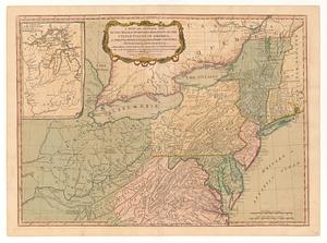
Map of the northern part of the United States of America
29.
Map of the northern parts of the United States of America
30.
A new and general map of the middle dominions belonging to the United States of America, viz. Virginia, Maryland, the...
31.
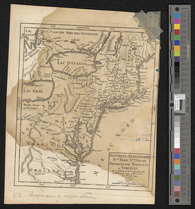
Nouvelle Angleterre, Nlle. York, Nlle. Jeersey, Pensilvanie, Mariland et Virginie
32.
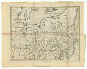
The Great Lakes and the Ohio, ca. 1800
33.
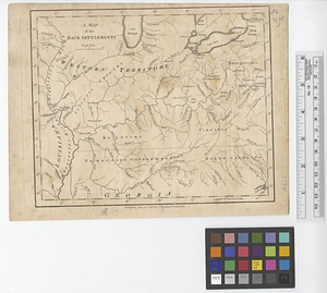
A map of the back settlements
34.
Map of the middle states, of America : comprehends New-York, New-Jersey, Pennsylvania, Delaware, and the territory n:w: of Ohio
35.
The 100th anniversary map of Abraham Lincoln's visit to Massachusetts, September 11-23, 1848
36.
1630 shoreline
37.
1879. Progress map of the U.S. Geographical Surveys west of the 100th Meridian : prepared under the direction of 1st Lieut....
38.
1903 Map of Salem and surrounding places
39.
19th annual convention of the National Association of Real Estate Boards : at Tulsa, June 7 to June 11 in 1926
40.
2005 significant U.S. hurricane strikes
‹ Prev
Next ›
1
2
3
4
5
6
…
432
433