Toggle navigation
LMEC Home
Exhibitions
Georeferencing
Tools for Teachers
Collections
My Favorites
Sign Up / Log In
Search
Search the map portal
Map Collection
Map Collection
Map Sets
Search
Search
Search for
Search In
All Fields
Creator
Title
Subject
Place
Search All Digital Collections
Advanced Search
8624 Results
My Search
Start Over
More Like
commonwealth:cj82kn152
Remove constraint More Like: commonwealth:cj82kn152
Filter your Search
Place
North and Central America
5,919
United States
4,843
Massachusetts
2,068
Europe
1,359
Suffolk (county)
1,043
Boston
1,016
Canada
454
Asia
422
more
Place
»
Topic
Boston (Mass.)--Maps
577
United States--Maps
273
Real property--Massachusetts--Boston--Maps
174
Massachusetts--Maps
160
Landowners--Massachusetts--Boston--Maps
132
North America--Maps--Early works to 1800
106
New England--Maps
99
New England--Maps--Early works to 1800
91
more
Topic
»
Date
Date range begin
–
Date range end
Current results range from
1482
to
2023
View distribution
Creator
United States. Hydrographic Office
594
O.H. Bailey & Co
148
Des Barres, Joseph F. W. (Joseph Frederick Wallet), 1722-1824
125
United States. Post Office Dept
120
Ptolemy, 2nd cent
100
Walling, Henry Francis, 1825-1888
94
Jefferys, Thomas, -1771
87
Geological Survey (U.S.)
86
more
Creator
»
Format
Maps/Atlases
8,565
Manuscripts
216
Prints
56
Books
36
Objects/Artifacts
10
Drawings/Illustrations
8
Posters
4
Georeferenced
Yes
876
No
7,748
Collection
Norman B. Leventhal Map & Education Center Collection
8,587
Boston and New England Maps
2,224
Urban Maps
1,937
Maritime Charts and Atlases
1,091
American Revolutionary War-Era Maps
654
Boston Redevelopment Authority Collection
87
Mapping Boston Collection
36
Sidney R. Knafel Map Collection at Phillips Academy
15
more
Collection
»
Available to use
No known restrictions
8,411
Creative Commons license
101
Search Constraints
Sort by relevance
relevance
title
date (asc)
date (desc)
Number of results to display per page
20 per page
10
per page
20
per page
50
per page
100
per page
View results as:
grid view
map view
Search Results
6581.
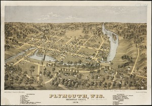
Plymouth, Wis : Sheboygan County, 1870
6582.
A pocket companion of Ireland : containing all the cities, market towns, boroughs, all ye great roads, and principal cross...
6583.
Pocket map of the city of Worcester, Mass : showing all streets, parks, distances, street car routes, location of public...
6584.
Pocket map showing the railroads, street railways, manufactories, deep water connections, blocks and subdivisions of the city...
6585.
Podrobnaia militernaia karta, po granits Rossii s Turtsieiu
6586.
The Point of Pines, Revere, Mass : on the Atlantic Ocean, eight miles north east of Boston : the most beautiful sea shore...
6587.
Poland
6588.
Poland
6589.
Poland & Lithuania
6590.
Poland, shewing the claims of Russia, Prussia & Austria, until the late depredations, the extent of which cannot as yet be...
6591.
Poli Arctici, et circumiacentium terrarum descriptio novissima
6592.
Political map of California. 1888
6593.
Political map of Connecticut 1888 ; Political map of New York 1888
6594.
Political map of Europe
6595.
Political map of Indiana. 1888
6596.
Political map of Michigan 1888
6597.
Political map of New Jersey 1888
6598.
Political map of the Balkan States
6599.
Political map of the United States and territories. 1888
6600.
Political map of the world, April 2001
‹ Prev
Next ›
1
2
…
326
327
328
329
330
331
332
333
334
…
431
432