Toggle navigation
LMEC Home
Exhibitions
Georeferencing
Tools for Teachers
Collections
My Favorites
Sign Up / Log In
Search
Search the map portal
Map Collection
Map Collection
Map Sets
Search
Search
Search for
Search In
All Fields
Creator
Title
Subject
Place
Search All Digital Collections
Advanced Search
8713 Results
My Search
Start Over
More Like
commonwealth:cj82km99w
Remove constraint More Like: commonwealth:cj82km99w
Filter your Search
Place
North and Central America
5,944
United States
4,862
Massachusetts
2,081
Europe
1,396
Suffolk (county)
1,046
Boston
1,019
Canada
452
Asia
438
more
Place
»
Topic
Boston (Mass.)--Maps
586
United States--Maps
282
Real property--Massachusetts--Boston--Maps
175
Massachusetts--Maps
165
Landowners--Massachusetts--Boston--Maps
133
New England--Maps
105
North America--Maps--Early works to 1800
103
Europe--Maps
79
more
Topic
»
Date
Date range begin
–
Date range end
Current results range from
1482
to
2023
View distribution
Creator
United States. Hydrographic Office
595
O.H. Bailey & Co
148
Des Barres, Joseph F. W. (Joseph Frederick Wallet), 1722-1824
123
United States. Post Office Dept
119
Ptolemy, 2nd cent
100
Walling, Henry Francis, 1825-1888
94
Geological Survey (U.S.)
86
Jefferys, Thomas, -1771
85
more
Creator
»
Format
Maps/Atlases
8,653
Manuscripts
215
Prints
56
Books
36
Objects/Artifacts
10
Drawings/Illustrations
8
Posters
5
Georeferenced
Yes
869
No
7,844
Collection
Norman B. Leventhal Map & Education Center Collection
8,695
Boston and New England Maps
2,234
Urban Maps
2,023
Maritime Charts and Atlases
1,083
American Revolutionary War-Era Maps
633
Boston Redevelopment Authority Collection
87
Maps from AAS
9
William L. Clements Library Collection
7
more
Collection
»
Available to use
No known restrictions
8,553
Creative Commons license
48
Search Constraints
Sort by relevance
relevance
title
date (asc)
date (desc)
Number of results to display per page
20 per page
10
per page
20
per page
50
per page
100
per page
View results as:
grid view
map view
Search Results
21.
A map of the State of Vermont
22.
Official highway map of the state of Vermont
23.
The state of New York with part of the adjacent states
24.
Vermont
25.
Vermont, from actual survey : with all the late additions & improvements
26.
Vermont from actual survey
27.
Vermont from actual survey
28.
Colton's New Hampshire
29.
Colton's New Hampshire
30.
Hammond's new road map of eastern Massachusetts and southern New Hampshire
31.
Manuscript maps of U.S. states
32.
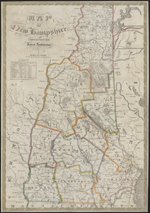
Map of New Hampshire : compiled from the latest authorities
33.
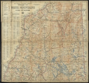
The National Publishing Company's topographic map of the White Mountains and central New Hampshire
34.
New Hampshire
35.
New Hampshire
36.
New Hampshire by recent survey : made under the supreme authority and published according to law
37.
New-Hampshire : from late survey
38.
Relief map of New Hampshire
39.
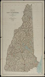
The state of New Hampshire
40.
The state of New Hampshire : compiled chiefly from actual surveys
‹ Prev
Next ›
1
2
3
4
5
6
…
435
436