Toggle navigation
LMEC Home
Exhibitions
Georeferencing
Tools for Teachers
Collections
My Favorites
Sign Up / Log In
Search
Search the map portal
Map Collection
Map Collection
Map Sets
Search
Search
Search for
Search In
All Fields
Creator
Title
Subject
Place
Search All Digital Collections
Advanced Search
8710 Results
My Search
Start Over
More Like
commonwealth:cj82km79d
Remove constraint More Like: commonwealth:cj82km79d
Filter your Search
Place
North and Central America
5,941
United States
4,856
Massachusetts
2,078
Europe
1,396
Suffolk (county)
1,045
Boston
1,018
Canada
449
Asia
438
more
Place
»
Topic
Boston (Mass.)--Maps
586
United States--Maps
282
Real property--Massachusetts--Boston--Maps
175
Massachusetts--Maps
162
Landowners--Massachusetts--Boston--Maps
133
North America--Maps--Early works to 1800
103
New England--Maps
102
Europe--Maps
79
more
Topic
»
Date
Date range begin
–
Date range end
Current results range from
1482
to
2023
View distribution
Creator
United States. Hydrographic Office
595
O.H. Bailey & Co
148
Des Barres, Joseph F. W. (Joseph Frederick Wallet), 1722-1824
123
United States. Post Office Dept
119
Ptolemy, 2nd cent
100
Walling, Henry Francis, 1825-1888
94
Geological Survey (U.S.)
86
Jefferys, Thomas, -1771
86
more
Creator
»
Format
Maps/Atlases
8,650
Manuscripts
216
Prints
56
Books
36
Objects/Artifacts
10
Drawings/Illustrations
8
Posters
5
Georeferenced
Yes
869
No
7,841
Collection
Norman B. Leventhal Map & Education Center Collection
8,693
Boston and New England Maps
2,232
Urban Maps
2,023
Maritime Charts and Atlases
1,084
American Revolutionary War-Era Maps
631
Boston Redevelopment Authority Collection
87
William L. Clements Library Collection
10
American Antiquarian Society Collection
3
more
Collection
»
Available to use
No known restrictions
8,551
Creative Commons license
49
Search Constraints
Sort by relevance
relevance
title
date (asc)
date (desc)
Number of results to display per page
20 per page
10
per page
20
per page
50
per page
100
per page
View results as:
grid view
map view
Search Results
41.
Topographical map of the District of Columbia and a portion of Virginia
42.
The tourist's pocket map of the state of Virginia : exhibiting its internal improvements, roads, distances &c
43.
Washington and vicinity
44.
An historical and literary map of the Old Line State of Maryland : showing forth divers curious and notable facts relating to...
45.
Index chart of natural oyster bars, crab bottoms, clam bars and triangulation stations of Maryland surveyed by Maryland Shell...
46.
Manuscript maps of U.S. states, possibly drawn by a schoolchild
47.
Map of eastern Virginia
48.
Map of eastern Virginia
49.
Map of the country embracing the several routes examined with a view to a national road from Washington to Lake Ontario
50.
Maryland
51.
The new war map of Virginia, Maryland & Pennsylvania
52.
Official map of the state of Virginia : from actual surveys by order of the executive, 1828 & 1859
53.
Seat of war in Virginia and Maryland
54.
Smith's topographical map of Virginia and Maryland
55.
The state of Maryland, from the best authorities
56.
State of West Virginia and part of Maryland : coal fields and producing districts
57.
A compleat plan of part of the province of Pennsylvania East and West Jersey shewing the transactions of the royal army under...
58.
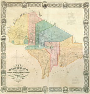
Map of Washington City
59.
Plan of part of the city of Washington : on which is shewn the squares, lots, &c., divided between William Prout Esq'r and the...
60.
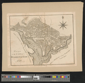
Plan of the city of Washington
‹ Prev
Next ›
1
2
3
4
5
6
7
…
435
436