Toggle navigation
LMEC Home
Exhibitions
Georeferencing
Tools for Teachers
Collections
My Favorites
Sign Up / Log In
Search
Search the map portal
Map Collection
Map Collection
Map Sets
Search
Search
Search for
Search In
All Fields
Creator
Title
Subject
Place
Search All Digital Collections
Advanced Search
8719 Results
My Search
Start Over
More Like
commonwealth:9s161g635
Remove constraint More Like: commonwealth:9s161g635
Filter your Search
Place
North and Central America
5,958
United States
4,861
Massachusetts
2,138
Europe
1,392
Suffolk (county)
1,042
Boston
1,015
Canada
449
Asia
437
more
Place
»
Topic
Boston (Mass.)--Maps
586
United States--Maps
279
Massachusetts--Maps
233
Real property--Massachusetts--Boston--Maps
175
Landowners--Massachusetts--Boston--Maps
133
North America--Maps--Early works to 1800
103
New England--Maps
102
Europe--Maps
79
more
Topic
»
Date
Date range begin
–
Date range end
Current results range from
1482
to
2023
View distribution
Creator
United States. Hydrographic Office
595
O.H. Bailey & Co
148
Des Barres, Joseph F. W. (Joseph Frederick Wallet), 1722-1824
123
United States. Post Office Dept
120
Ptolemy, 2nd cent
100
Walling, Henry Francis, 1825-1888
95
Geological Survey (U.S.)
92
Jefferys, Thomas, -1771
85
more
Creator
»
Format
Maps/Atlases
8,658
Manuscripts
217
Prints
56
Books
36
Objects/Artifacts
10
Drawings/Illustrations
8
Posters
5
Ephemera
1
Georeferenced
Yes
878
No
7,841
Collection
Norman B. Leventhal Map & Education Center Collection
8,688
Boston and New England Maps
2,266
Urban Maps
1,993
Maritime Charts and Atlases
1,083
American Revolutionary War-Era Maps
634
Boston Redevelopment Authority Collection
90
Applied Geographics, Inc. Records
19
David Judkins Weaver Papers
17
more
Collection
»
Available to use
No known restrictions
8,546
Creative Commons license
51
Search Constraints
Sort by relevance
relevance
title
date (asc)
date (desc)
Number of results to display per page
20 per page
10
per page
20
per page
50
per page
100
per page
View results as:
grid view
map view
Search Results
201.
Massachusetts land use - 1985
202.
Massachusetts land use - 1985
203.
Massachusetts navigation and dredging management study
204.
Massachusetts open space and recreation facilities
205.
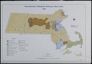
Massachusetts orthophoto basemap sheet index
206.
Massachusetts orthophoto basemap sheet index
207.
Massachusetts outdoor recreation plan 1966 : public outdoor recreation areas
208.
Massachusetts river basins
209.
Massachusetts river basins
210.
Massachusetts watersheds land use
211.
Metacomet-Monadnock Trail : an analysis of landuse
212.
Official topographical atlas of Massachusetts : from astronomical, trigonometrical and various local surveys
213.
Orthophoto index
214.
Orthophoto quads index
215.
Plan of Damons land
216.
Plan of the roads between Boston and Albany : survey'd by order of the governor in pursuance of a resolution of the General...
217.
Properties of the Trustees of Reservations and other protected open space
218.
Proposals of Osgood Carleton and John Norman, for publishing by subscription, an accurate map of the commonwealth of...
219.
DEM protected open space
220.
Province of the Massachusetts Bay & pursuant to an order made by the great & Genl. Court of the province June 11th 1762 : to me...
‹ Prev
Next ›
1
2
…
7
8
9
10
11
12
13
14
15
…
435
436