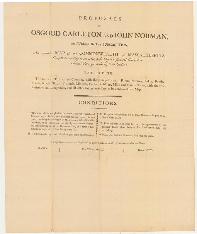
Proposals of Osgood Carleton and John Norman, for publishing by subscription, an accurate map of the commonwealth of Massachusetts, compiled according to an act, passed by the general court, from actual surveys made by their order : exhibiting, the lines of towns and counties, with the principal roads, rivers, streams, lakes, ponds, islands, rocks, shoals, channels, minerals, public buildings, mills and manufactories, with the true latitudes and longitudes, and all other things necessary to be contained in a map
This map is also available in American Revolutionary Geographies Online (ARGO), a collections portal especially built for material relating to the American Revolutionary War Era. Visit ARGO to learn more about this item and explore the historical geography of North America in the late eighteenth century.
Item Information
- Title:
- Proposals of Osgood Carleton and John Norman, for publishing by subscription, an accurate map of the commonwealth of Massachusetts, compiled according to an act, passed by the general court, from actual surveys made by their order : exhibiting, the lines of towns and counties, with the principal roads, rivers, streams, lakes, ponds, islands, rocks, shoals, channels, minerals, public buildings, mills and manufactories, with the true latitudes and longitudes, and all other things necessary to be contained in a map
- Author:
- Carleton, Osgood, 1742-1816
- Publisher:
- Norman, John, 1748?-1817
- Date:
-
[1797]
- Format:
-
Ephemera
- Genre:
-
Forms (Documents)
Broadsides
- Location:
- MacLean Collection Map Library
- Collection (local):
-
MacLean Collection Map Library
- Subjects:
-
Massachusetts--Maps
Map industry and trade--Massachusetts--Boston
Publishers and publishing--Massachusetts--Boston
- Places:
-
Massachusetts
- Extent:
- 1 sheet ; 39 x 32 cm
- Terms of Use:
-
Public Domain/No known restrictions on use. Contact host institution to download image.
Contact host institution for more information.
- Publisher:
-
[Boston] :
[John Norman]
- Language:
-
English
- Notes:
-
Area at bottom for people to subscribe and order maps.
- Notes (date):
-
This date is inferred.
- Identifier:
-
MC21484_Carleton_Mass_proposal_1797
- Call #:
-
21484


