Toggle navigation
LMEC Home
Exhibitions
Georeferencing
Tools for Teachers
Collections
My Favorites
Sign Up / Log In
Search
Search the map portal
Map Collection
Map Collection
Map Sets
Search
Search
Search for
Search In
All Fields
Creator
Title
Subject
Place
Search All Digital Collections
Advanced Search
8775 Results
My Search
Start Over
More Like
commonwealth:9s161f90v
Remove constraint More Like: commonwealth:9s161f90v
Filter your Search
Place
North and Central America
6,006
United States
4,923
Massachusetts
2,089
Europe
1,396
Suffolk (county)
1,124
Boston
1,097
Canada
449
Asia
438
more
Place
»
Topic
Boston (Mass.)--Maps
607
United States--Maps
282
Real property--Massachusetts--Boston--Maps
253
Landowners--Massachusetts--Boston--Maps
170
Massachusetts--Maps
163
City planning--Massachusetts--Boston--Maps
108
North America--Maps--Early works to 1800
103
New England--Maps
102
more
Topic
»
Date
Date range begin
–
Date range end
Current results range from
1482
to
2023
View distribution
Creator
United States. Hydrographic Office
595
O.H. Bailey & Co
148
Des Barres, Joseph F. W. (Joseph Frederick Wallet), 1722-1824
123
United States. Post Office Dept
120
Boston Redevelopment Authority
111
Ptolemy, 2nd cent
100
Walling, Henry Francis, 1825-1888
94
Geological Survey (U.S.)
87
more
Creator
»
Format
Maps/Atlases
8,715
Manuscripts
215
Prints
56
Books
36
Objects/Artifacts
10
Drawings/Illustrations
8
Posters
5
Georeferenced
Yes
869
No
7,906
Collection
Norman B. Leventhal Map & Education Center Collection
8,695
Boston and New England Maps
2,276
Urban Maps
2,066
Maritime Charts and Atlases
1,083
American Revolutionary War-Era Maps
616
Boston Redevelopment Authority Collection
130
Massachusetts Real Estate Atlases
37
Applied Geographics, Inc. Records
1
Available to use
No known restrictions
8,596
Creative Commons license
47
Search Constraints
Sort by relevance
relevance
title
date (asc)
date (desc)
Number of results to display per page
20 per page
10
per page
20
per page
50
per page
100
per page
View results as:
grid view
map view
Search Results
4481.
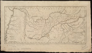
A map of the Tennassee Government formerly a part of North Carolina from the latest surveys
4482.
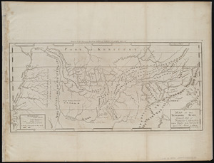
A map of the Tennassee state formerly part of North Carolina taken chiefly from surveys by Genl. D. Smith & others
4483.
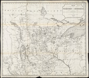
Map of the territory of Minnesota exhibiting the route of the expedition to the Red River of the north, in the summer of 1849
4484.
Map of the Texas, Topolobampo and Pacific Railroad and Telegraph Cpy. (Western Division) : from Chihuahua and Parral to...
4485.
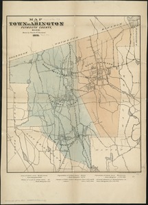
Map of the town of Abington Plymouth County, Mass
4486.
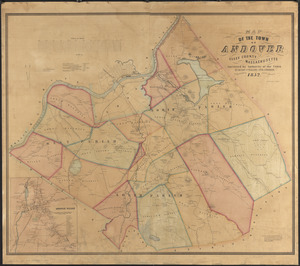
Map of the town of Andover, Essex County, Massachusetts
4487.
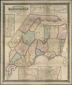
Map of the town of Barnstable, Barnstable County, Mass
4488.
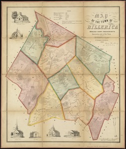
Map of the town of Billerica, Middlesex County, Massachusetts : surveyed by order of the town
4489.
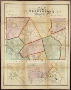
Map of the town of Blackstone, Worcester County, Mass : surveyed by order of the town
4490.
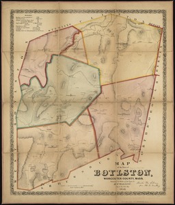
Map of the town of Boylston, Worcester County, Mass : surveyed by order of the town
4491.
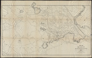
Map of the town of Brookline : 1894
4492.
Map of the town of Brookline : 1893
4493.
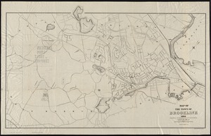
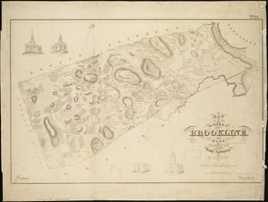
Map of the town of Brookline, Mass. : made by order of the town authorities from actual survey
4494.
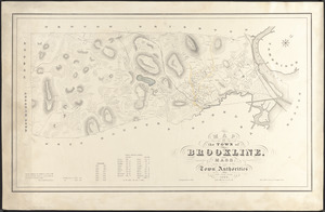
Map of the town of Brookline, Mass : surveyed in 1844 by order of the Town Authorities
4495.
Map of the town of Canaan N.H : Grafton Co
4496.
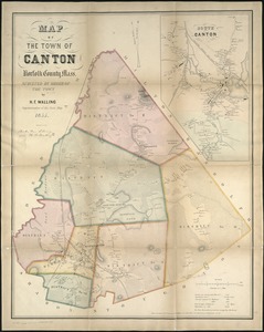
Map of the town of Canton, Norfolk County, Mass
4497.
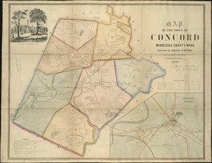
Map of the town of Concord : Middlesex County Mass., surveyed by authority of the town
4498.
Map of the town of Danvers
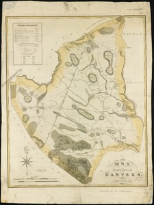
4499.
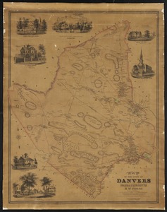
Map of the town of Danvers Massachusetts
4500.
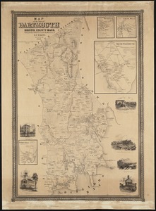
Map of the town of Dartmouth, Bristol County Mass
‹ Prev
Next ›
1
2
…
221
222
223
224
225
226
227
228
229
…
438
439