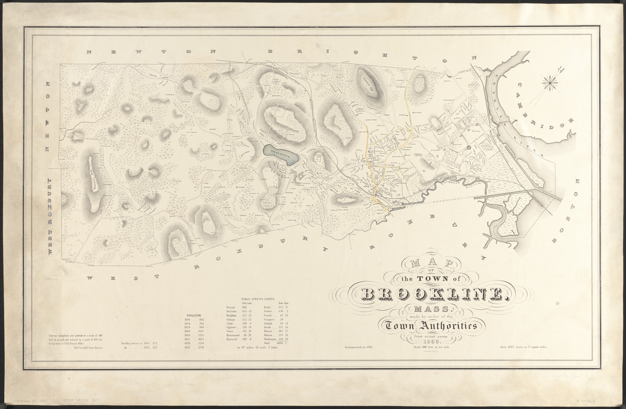
Map of the town of Brookline, Mass. : made by order of the town authorities from actual survey
Item Information
- Title:
- Map of the town of Brookline, Mass. : made by order of the town authorities from actual survey
- Cartographer:
- T. & J. Doane (Firm)
- Publisher:
- L.H. Bradford & Co.
- Date:
-
1855
- Format:
-
Maps/Atlases
- Location:
-
Boston Public Library
Norman B. Leventhal Map & Education Center - Collection (local):
-
Norman B. Leventhal Map & Education Center Collection
- Subjects:
-
Real property--Massachusetts--Brookline--Maps
Landowners--Massachusetts--Brookline--Maps
Brookline (Mass.)--Maps
- Places:
-
MassachusettsNorfolk (county)Brookline
- Extent:
- 1 map : hand colored ; 53 x 91 cm
- Terms of Use:
-
No known copyright restrictions.
No known restrictions on use.
- Publisher:
-
[Boston] :
L.H. Bradford & Co's Lith.
- Scale:
-
Scale 1:9,600
- Language:
-
English
- Notes:
-
Shows buildings with names of property owners.
Relief shown by hachures.
"Surveys completed and plotted on a scale of 400 ft. to an in. and reduced to a scale of 800 ft. to an in. at T. & J. Doane's Office."
Oriented with north toward the upper right.
Includes tables of population and public street lengths.
- Identifier:
-
06_01_016158
- Call #:
-
G3764.B9 1855 .T25
- Barcode:
-
39999085943817


