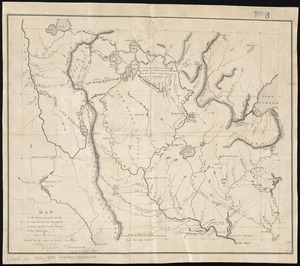
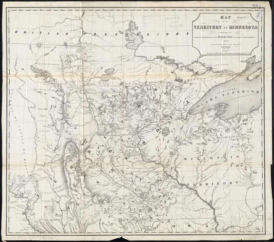
Map of the territory of Minnesota exhibiting the route of the expedition to the Red River of the north, in the summer of 1849
Item Information
- Title:
- Map of the territory of Minnesota exhibiting the route of the expedition to the Red River of the north, in the summer of 1849
- Creator:
- Pope, John, 1822-1892
- Name on Item:
-
by Captn. John Pope, Corps Top. Engrs. ; drawn by P. S. Morawski.
- Date:
-
[1849]
- Format:
-
Maps/Atlases
- Location:
-
Boston Public Library
Norman B. Leventhal Map & Education Center - Collection (local):
-
Norman B. Leventhal Map & Education Center Collection
- Subjects:
-
Minnesota--Discovery and exploration--Maps
- Places:
-
Minnesota
- Extent:
- 1 map ; 61 x 70 cm
- Terms of Use:
-
No known copyright restrictions.
No known restrictions on use.
- Publisher:
-
[Washington, D.C.] :
[publisher not identified]
- Scale:
-
Scale approximately 1:1,230,000
- Language:
-
English
- Notes:
-
Relief shown by hachures and spot heights.
Gives both Indian and later place names.
Shows "Proposed line of grants for railroads."
- Notes (date):
-
This date is inferred.
- Identifier:
-
06_01_011277
- Call #:
-
G4140 1849 .P67
- Barcode:
-
39999065683656
- LCCN:
-
74696065