Map of the town of Canaan N.H : Grafton Co
Item Information
- Title:
- Map of the town of Canaan N.H : Grafton Co
- Creator:
- Eaton, W. C. (William C.)
- Name on Item:
-
surveyed & drawn by Wm. C. Eaton.
- Date:
-
[1855]
- Format:
-
Maps/Atlases
- Location:
-
Boston Public Library
Norman B. Leventhal Map & Education Center - Collection (local):
-
Norman B. Leventhal Map & Education Center Collection
- Subjects:
-
Landowners--New Hampshire--Canaan--Maps
Canaan (N.H.)--Maps
- Places:
-
New HampshireGrafton (county)Canaan
- Extent:
- 1 map : col. ; 77 x 127 cm.
- Terms of Use:
-
No known copyright restrictions.
No known restrictions on use.
- Publisher:
-
Philadelphia :
E.M. Woodford
- Scale:
-
Scale ca. 1:19,800.
- Language:
-
English
- Notes:
-
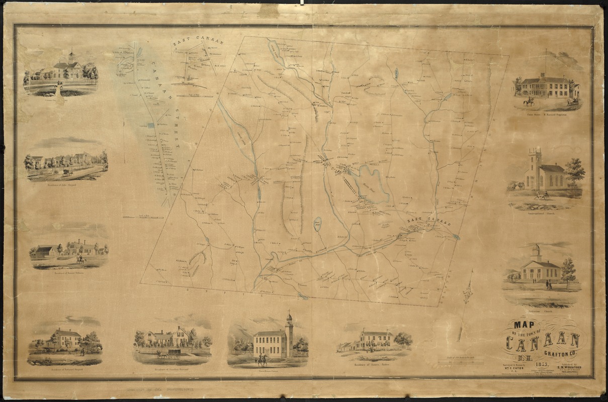
Relief shown by hachures.
Oriented with north toward the upper right.
Includes 10 ill. of residences and places of interest.
Ancillary maps: Canaan Street; East Canaan.
Gives names of property owners.
Lith. by W.H. Rease. Printed by Wagner & McGuigan.
- Notes (date):
-
This date is inferred.
- Identifier:
-
06_01_007507
- Call #:
-
G3744.C329 1855 .E28x
- Barcode:
-
39999059032522


