Toggle navigation
LMEC Home
Exhibitions
Georeferencing
Tools for Teachers
Collections
My Favorites
Sign Up / Log In
Search
Search the map portal
Map Collection
Map Collection
Map Sets
Search
Search
Search for
Search In
All Fields
Creator
Title
Subject
Place
Search All Digital Collections
Advanced Search
101 Results
My Search
Start Over
More Like
commonwealth:9p296d59b
Remove constraint More Like: commonwealth:9p296d59b
Filter your Search
Place
North and Central America
86
United States
85
Massachusetts
52
Virginia
13
Boston
8
Suffolk (county)
8
Connecticut
5
Essex (county)
5
more
Place
»
Topic
Massachusetts--Maps
18
United States--History--Civil War, 1861-1865--Maps
10
Land use--Massachusetts--Maps
7
Virginia--History--Civil War, 1861-1865--Maps
7
Connecticut--Maps
6
Watersheds--Massachusetts--Maps
5
Boston Metropolitan Area (Mass.)--Maps
4
New England--Maps
4
more
Topic
»
Date
Date range begin
–
Date range end
Current results range from
1867
to
2015
View distribution
Creator
MassGIS (Office : Mass.)
21
Massachusetts. Executive Office of Environmental Affairs
17
Michler, N. (Nathaniel), 1827-1881
15
New York Lithographing, Engraving and Printing Co.
12
Strasser, J.
12
Theilkuhl, F.
12
Weyss, J. E.
12
Geological Survey (U.S.)
10
more
Creator
»
Format
Maps/Atlases
98
Ephemera
2
Documents
1
Posters
1
Georeferenced
No
101
Collection
Norman B. Leventhal Map & Education Center Collection
101
David Judkins Weaver Papers
98
Boston and New England Maps
65
Urban Maps
7
Applied Geographics, Inc. Records
4
Available to use
No known restrictions
101
Search Constraints
Sort by relevance
relevance
title
date (asc)
date (desc)
Number of results to display per page
20 per page
10
per page
20
per page
50
per page
100
per page
View results as:
grid view
map view
Search Results
41.
Major transportation system : Boston region MAPC area
42.
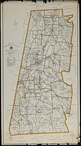
Map of Berkshire County, Massachusetts
43.
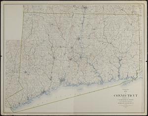
Map of Connecticut
44.
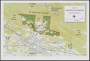
Map of Greylock center site, Adams, Massachusetts
45.
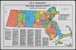
Map of Massachusetts : state Senate legislative districts : (Chapter 305 of the Acts of 1987)
46.
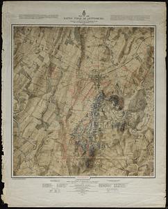
Map of the battle field of Gettysburg : July 1st, 2nd, 3rd, 1863
47.
Map of United States showing drainage areas and index numbers
48.
Massachusetts areas of critical environmental concern
49.
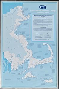
Massachusetts coastal zone management program : volume 1, summary map
50.
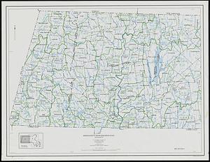
Massachusetts drainage basins
51.
Massachusetts land use - 1985
52.
Massachusetts land use - 1985
53.
Massachusetts open space and recreation facilities
54.
Massachusetts river basins
55.
Massachusetts river basins
56.
Massachusetts shoreline change summary map
57.
Massachusetts water resources study
58.
Metacomet-Monadnock Trail : an analysis of landuse
59.
New England fishery, recreation and scenic resources
60.
New England regional transportation map = Mapa do transporte regional da Nova Inglaterra = Nueva Inglaterra, mapa regional de...
‹ Prev
Next ›
1
2
3
4
5
6