Toggle navigation
LMEC Home
Exhibitions
Georeferencing
Tools for Teachers
Collections
My Favorites
Sign Up / Log In
Search
Search the map portal
Map Collection
Map Collection
Map Sets
Search
Search
Search for
Search In
All Fields
Creator
Title
Subject
Place
Search All Digital Collections
Advanced Search
8777 Results
My Search
Start Over
More Like
commonwealth:8049g9715
Remove constraint More Like: commonwealth:8049g9715
Filter your Search
Place
North and Central America
5,984
United States
4,919
Massachusetts
2,079
Europe
1,396
Suffolk (county)
1,046
Boston
1,019
Canada
469
Asia
438
more
Place
»
Topic
Boston (Mass.)--Maps
586
United States--Maps
282
Real property--Massachusetts--Boston--Maps
175
Massachusetts--Maps
162
Landowners--Massachusetts--Boston--Maps
133
North America--Maps--Early works to 1800
110
United States--Maps--Early works to 1800
103
New England--Maps
102
more
Topic
»
Date
Date range begin
–
Date range end
Current results range from
1482
to
2023
View distribution
Creator
United States. Hydrographic Office
595
O.H. Bailey & Co
148
Des Barres, Joseph F. W. (Joseph Frederick Wallet), 1722-1824
123
United States. Post Office Dept
120
Ptolemy, 2nd cent
100
Walling, Henry Francis, 1825-1888
94
Jefferys, Thomas, -1771
87
Geological Survey (U.S.)
86
more
Creator
»
Format
Maps/Atlases
8,717
Manuscripts
216
Prints
56
Books
36
Objects/Artifacts
10
Drawings/Illustrations
8
Posters
5
Georeferenced
Yes
873
No
7,904
Collection
Norman B. Leventhal Map & Education Center Collection
8,696
Boston and New England Maps
2,233
Urban Maps
2,023
Maritime Charts and Atlases
1,083
American Revolutionary War-Era Maps
697
Boston Redevelopment Authority Collection
87
MacLean Collection Map Library
45
New York Public Library Collection
16
more
Collection
»
Available to use
No known restrictions
8,556
Creative Commons license
78
Search Constraints
Sort by relevance
relevance
title
date (asc)
date (desc)
Number of results to display per page
20 per page
10
per page
20
per page
50
per page
100
per page
View results as:
grid view
map view
Search Results
21.
A Map of the British American plantations, extending from Boston in New England to Georgia : including all the back settlements...
22.
A map of the northern and middle states : comprehending the western territory & the British dominions in North America : from...
23.
Map of the United States exhibiting the post-roads, the situations, connections & distances of the post-offices, stage roads,...
24.
Map of the United States in North America : with the British, French and Spanish dominions adjoining, according to the treaty...
25.
A new map of North America
26.
A new map of the United States of North America with the British dominions on that continent &c
27.
Partie de l'Amérique septentrionale, qui comprend le cours de l'Ohio, la Nlle. Angleterre, la Nlle York, le New Jersey, la...
28.
States of America, drawn from the best authorities
29.
The United States of America with the British possessions of Canada, Nova Scotia, & of Newfoundland, divided with the French :...
30.
The United States of America with the British possessions of Canada, Nova Scotia, New Brunswick and Newfoundland divided with...
31.
The United States of North America : with the British & Spanish territories according to the treaty
32.
The United States of North America : with the British territories and those of Spain according to the treaty of 1784
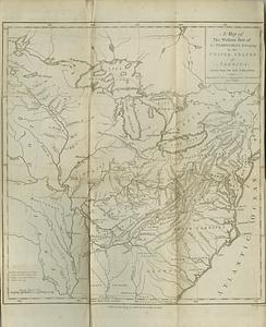
33.
A map of the western part of the territories belonging to the United States of America : drawn from the best authorities
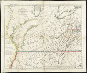
34.
A new map of the western parts of Virginia, Pennsylvania, Maryland and North Carolina : comprehending the river Ohio, and all...
35.
Partie occidentale de la Virginie, Pensylvanie, Maryland, et Caroline septle. la Rivière d'Ohio, et toutes celles qui s'y...
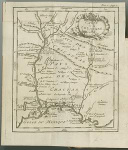
36.
Carte de la Louisiane
37.
Carte de la Louisiane et des pays voisins : dédiée à M. Rouillé, sécretaire d'État, ayant le Département de la marine
38.
Carte du Cap Franc̨ois de Saint Domingue, de l'isle de Cuba, de la Jamaique avec le canal de Bahama, l'entrée du fleuve St....
39.
An accurate map of the English colonies in North America, bordering on the river Ohio
40.
An accurate map of the United States of America : according to the Treaty of Peace of 1783
‹ Prev
Next ›
1
2
3
4
5
6
…
438
439