Toggle navigation
LMEC Home
Exhibitions
Georeferencing
Tools for Teachers
Collections
My Favorites
Sign Up / Log In
Search
Search the map portal
Map Collection
Map Collection
Map Sets
Search
Search
Search for
Search In
All Fields
Creator
Title
Subject
Place
Search All Digital Collections
Advanced Search
8565 Results
My Search
Start Over
More Like
commonwealth:7h14b246p
Remove constraint More Like: commonwealth:7h14b246p
Filter your Search
Place
North and Central America
5,860
United States
4,784
Massachusetts
2,052
Europe
1,359
Suffolk (county)
1,034
Boston
1,007
Canada
463
Asia
422
more
Place
»
Topic
Boston (Mass.)--Maps
577
United States--Maps
273
Real property--Massachusetts--Boston--Maps
174
Massachusetts--Maps
160
Landowners--Massachusetts--Boston--Maps
132
North America--Maps--Early works to 1800
103
New England--Maps
99
Europe--Maps
78
more
Topic
»
Date
Date range begin
–
Date range end
Current results range from
1482
to
2023
View distribution
Creator
United States. Hydrographic Office
594
O.H. Bailey & Co
148
Des Barres, Joseph F. W. (Joseph Frederick Wallet), 1722-1824
123
United States. Post Office Dept
120
Ptolemy, 2nd cent
100
Walling, Henry Francis, 1825-1888
94
Geological Survey (U.S.)
86
Jefferys, Thomas, -1771
85
more
Creator
»
Format
Maps/Atlases
8,506
Manuscripts
215
Prints
56
Books
36
Objects/Artifacts
10
Drawings/Illustrations
8
Posters
4
Georeferenced
Yes
869
No
7,696
Collection
Norman B. Leventhal Map & Education Center Collection
8,549
Boston and New England Maps
2,204
Urban Maps
1,936
Maritime Charts and Atlases
1,081
American Revolutionary War-Era Maps
632
Boston Redevelopment Authority Collection
87
William L. Clements Library Collection
16
Available to use
No known restrictions
8,408
Creative Commons license
46
Search Constraints
Sort by relevance
relevance
title
date (asc)
date (desc)
Number of results to display per page
20 per page
10
per page
20
per page
50
per page
100
per page
View results as:
grid view
map view
Search Results
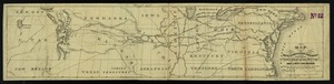
1.
Map of the route to the Kansas gold mines : prepared from government and other surveys : showing the most direct railroad...
2.
Southern Railway system
3.
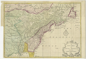
A new map of the United States including part of Louisiana : from the best authorities
4.
Vereinigte Staaten von Nord-Amerika in 6 blattern, bl. 3
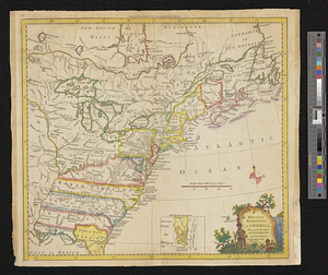
5.
An accurate map of the British empire in Nth. America as settled by the preliminaries in 1762
6.
British dominions in America, drawn from the latest and best authorities
7.
A map of the British and French settlements in North America
8.
Map of the European settlements in North America
9.
A map of the French settlements in North America
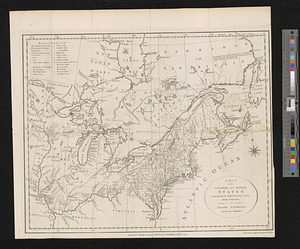
10.
A map of the northern and middle states; comprehending the western territory and the British dominions in North America from...
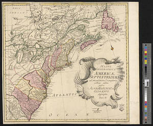
11.
Mappa geographica Americae Septentrionalis ad emendatiora exemplaria adhuc edita jussu Acad. Reg. Scient. et eleg. litt. descripta
12.
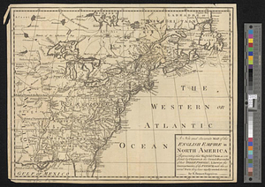
A new and accurate map of the English empire in North America : representing their rightful claim as confirm'd by charters, &...
13.
A new and accurate map of the English empire in North America : representing their rightful claim as confirm'd by charters, and...
14.
A new and accurate map of the present war in North America
15.
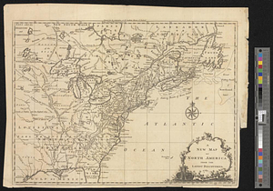
A new map of North America from the latest discoveries 1761
16.
A new map of North America from the latest discoveries 1763
17.
A new map of the British dominions in North America with the limits of the governments annexed thereto by the late treaty of...
18.
A new map of the British empire in Nth. America, drawn from the latest authorities
19.
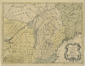
A new map of the western parts of Virginia, Pennsylvania, Maryland and North Carolina; comprehending the river Ohio, and all...
20.
North America east of the Mississippi, ca. 1790
‹ Prev
Next ›
1
2
3
4
5
…
428
429