Toggle navigation
LMEC Home
Exhibitions
Georeferencing
Tools for Teachers
Collections
My Favorites
Sign Up / Log In
Search
Search the map portal
Map Collection
Map Collection
Map Sets
Search
Search
Search for
Search In
All Fields
Creator
Title
Subject
Place
Search All Digital Collections
Advanced Search
8779 Results
My Search
Start Over
More Like
commonwealth:7h14b147r
Remove constraint More Like: commonwealth:7h14b147r
Filter your Search
Place
North and Central America
6,010
United States
4,907
Massachusetts
2,150
Europe
1,396
Suffolk (county)
1,047
Boston
1,020
Canada
450
Asia
438
more
Place
»
Topic
Boston (Mass.)--Maps
590
United States--Maps
282
Massachusetts--Maps
235
Real property--Massachusetts--Boston--Maps
175
Landowners--Massachusetts--Boston--Maps
133
New England--Maps
104
North America--Maps--Early works to 1800
103
Europe--Maps
79
more
Topic
»
Date
Date range begin
–
Date range end
Current results range from
1482
to
2023
View distribution
Creator
United States. Hydrographic Office
595
O.H. Bailey & Co
148
Des Barres, Joseph F. W. (Joseph Frederick Wallet), 1722-1824
123
United States. Post Office Dept
120
Ptolemy, 2nd cent
100
Walling, Henry Francis, 1825-1888
95
Geological Survey (U.S.)
93
Jefferys, Thomas, -1771
85
more
Creator
»
Format
Maps/Atlases
8,718
Manuscripts
217
Prints
56
Books
36
Objects/Artifacts
10
Drawings/Illustrations
8
Posters
5
Ephemera
1
Georeferenced
Yes
879
No
7,900
Collection
Norman B. Leventhal Map & Education Center Collection
8,739
Boston and New England Maps
2,281
Urban Maps
2,024
Maritime Charts and Atlases
1,083
American Revolutionary War-Era Maps
643
Boston Redevelopment Authority Collection
90
Applied Geographics, Inc. Records
20
David Judkins Weaver Papers
20
more
Collection
»
Available to use
No known restrictions
8,597
Creative Commons license
51
Search Constraints
Sort by relevance
relevance
title
date (asc)
date (desc)
Number of results to display per page
20 per page
10
per page
20
per page
50
per page
100
per page
View results as:
grid view
map view
Search Results
8061.
To the Right Honourable John Lord Sommers, Baron of Evesham in ye county of Worcester, president of Her Majesty's most...
8062.
To the Right Honourable the Master, Wardens, & Elder Bretham of the Trinity House, this chart of the entrances to The River...
8063.
To the Right Honourable William, Lord Cowper, Lord High Chancellor of Great Britain, this map of Asia : according to ye newest...
8064.
To the select-men of the town of Boston, in the Commonwealth of Massachusetts; ever distinguished for their zeal for the good...
8065.
Tobago
8066.
Tobago from actual surveys and observations
8067.
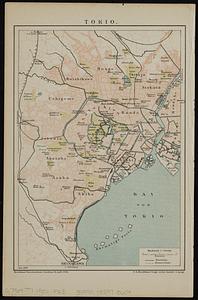
Tokio
8068.
Tomlinsons map of Petersburg : showing the scene of Genl. Grants operations
8069.
Tonto National Forest, Arizona
8070.
Topographia aug. Turon. ducatus et confinium Galliae celticae sinu complectitur cuius latitudo ab aequinoctiali versus...
8071.
Topographic & detail sheets of Rainy Lake & upper boundary waters
8072.
Topographic map of Brighton and Allston
8073.
Topographic map of Clinton County, Illinois
8074.
Topographic map of Gallatin County, Illinois
8075.
Topographic map of Hardin County, Illinois
8076.
Topographic map of Lawrence County, Illinois
8077.
The topographic map of Manchoukuo
8078.
Topographic map of McDonough County, Illinois
8079.
Topographic map of Monroe County, Illinois
8080.
Topographic map of Randolph County, Illinois
‹ Prev
Next ›
1
2
…
400
401
402
403
404
405
406
407
408
…
438
439