Toggle navigation
LMEC Home
Exhibitions
Georeferencing
Tools for Teachers
Collections
My Favorites
Sign Up / Log In
Search
Search the map portal
Map Collection
Map Collection
Map Sets
Search
Search
Search for
Search In
All Fields
Creator
Title
Subject
Place
Search All Digital Collections
Advanced Search
8550 Results
My Search
Start Over
More Like
commonwealth:7h149z95t
Remove constraint More Like: commonwealth:7h149z95t
Filter your Search
Place
North and Central America
5,845
United States
4,769
Massachusetts
2,052
Europe
1,359
Suffolk (county)
1,034
Boston
1,007
Canada
448
Asia
422
more
Place
»
Topic
Boston (Mass.)--Maps
577
United States--Maps
273
Real property--Massachusetts--Boston--Maps
174
Massachusetts--Maps
160
Landowners--Massachusetts--Boston--Maps
132
North America--Maps--Early works to 1800
103
New England--Maps
99
Europe--Maps
78
more
Topic
»
Date
Date range begin
–
Date range end
Current results range from
1482
to
2023
View distribution
Creator
United States. Hydrographic Office
594
O.H. Bailey & Co
148
Des Barres, Joseph F. W. (Joseph Frederick Wallet), 1722-1824
123
United States. Post Office Dept
120
Ptolemy, 2nd cent
100
Walling, Henry Francis, 1825-1888
94
Geological Survey (U.S.)
86
Jefferys, Thomas, -1771
85
more
Creator
»
Format
Maps/Atlases
8,491
Manuscripts
215
Prints
56
Books
36
Objects/Artifacts
10
Drawings/Illustrations
8
Posters
4
Georeferenced
Yes
869
No
7,681
Collection
Norman B. Leventhal Map & Education Center Collection
8,549
Boston and New England Maps
2,204
Urban Maps
1,936
Maritime Charts and Atlases
1,081
American Revolutionary War-Era Maps
616
Boston Redevelopment Authority Collection
87
Sidney R. Knafel Map Collection at Phillips Academy
1
Available to use
No known restrictions
8,408
Creative Commons license
46
Search Constraints
Sort by relevance
relevance
title
date (asc)
date (desc)
Number of results to display per page
20 per page
10
per page
20
per page
50
per page
100
per page
View results as:
grid view
map view
Search Results
1.
Asia : with the islands adioyning described, the atire of the people, & townes of importance, all of them newly augmented
2.
Asia noviter delineata
3.
Asia noviter delineata
4.
Asiae noua descriptio
5.
Asiae nova
6.
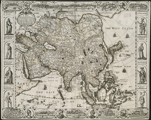
A map of the East-Indies and the adjacent countries, with the settlements, factories and territories, explaning [sic] what...
7.
A map of the n.e. part of Asia, and n.w. parts of America, shewing their situations with respect to Japan
8.
Maris Pacifici (quod vulgo Mar del Zur) cum regionibus circumiacentibus, insulisque in eodem passim sparsis, novissima descriptio
9.
A new, plaine, and exact map of Asia : described by N.I. Visscher, and done into English, enlarged, and corrected, according to...
10.
To the Right Honourable William, Lord Cowper, Lord High Chancellor of Great Britain, this map of Asia : according to ye newest...
11.
Maris Pacifici (quod vulgo Mar del Zur) cum regionibus circumiacentibus, insulisque in eodem passim sparsis, novissima descriptio
12.
The 100th anniversary map of Abraham Lincoln's visit to Massachusetts, September 11-23, 1848
13.
1630 shoreline
14.
1879. Progress map of the U.S. Geographical Surveys west of the 100th Meridian : prepared under the direction of 1st Lieut....
15.
1903 Map of Salem and surrounding places
16.
19th annual convention of the National Association of Real Estate Boards : at Tulsa, June 7 to June 11 in 1926
17.
2005 significant U.S. hurricane strikes
18.
The 2100 project : an atlas for the Green New Deal
19.
227 Harzgerode
20.
305 Glatz
‹ Prev
Next ›
1
2
3
4
5
…
427
428


![A map of the East-Indies and the adjacent countries, with the settlements, factories and territories, explaning [sic] what belongs to England, Spain, France, Holland, Denmark, Portugal &c. with many remarks not extant in any other map](https://bpldcassets.blob.core.windows.net/derivatives/images/commonwealth:cj82ks68x/image_thumbnail_300.jpg)