Toggle navigation
LMEC Home
Exhibitions
Georeferencing
Tools for Teachers
Collections
My Favorites
Sign Up / Log In
Search
Search the map portal
Map Collection
Map Collection
Map Sets
Search
Search
Search for
Search In
All Fields
Creator
Title
Subject
Place
Search All Digital Collections
Advanced Search
9053 Results
My Search
Start Over
More Like
commonwealth:7940bf647
Remove constraint More Like: commonwealth:7940bf647
Filter your Search
Place
North and Central America
6,284
United States
5,202
Massachusetts
2,152
Suffolk (county)
1,404
Europe
1,396
Boston
1,377
Canada
449
Asia
438
more
Place
»
Topic
Boston (Mass.)--Maps
679
City planning--Massachusetts--Boston--Maps
418
United States--Maps
282
Urban renewal--Massachusetts--Boston--Maps
253
Real property--Massachusetts--Boston--Maps
217
Massachusetts--Maps
162
Landowners--Massachusetts--Boston--Maps
135
North America--Maps--Early works to 1800
103
more
Topic
»
Date
Date range begin
–
Date range end
Current results range from
1482
to
2023
View distribution
Creator
United States. Hydrographic Office
595
Boston Redevelopment Authority
392
O.H. Bailey & Co
148
Des Barres, Joseph F. W. (Joseph Frederick Wallet), 1722-1824
123
United States. Post Office Dept
120
Ptolemy, 2nd cent
100
Walling, Henry Francis, 1825-1888
94
Geological Survey (U.S.)
86
more
Creator
»
Format
Maps/Atlases
8,993
Manuscripts
215
Prints
56
Books
36
Objects/Artifacts
10
Drawings/Illustrations
8
Posters
5
Georeferenced
Yes
870
No
8,183
Collection
Norman B. Leventhal Map & Education Center Collection
8,696
Boston and New England Maps
2,591
Urban Maps
2,377
Maritime Charts and Atlases
1,083
American Revolutionary War-Era Maps
616
Boston Redevelopment Authority Collection
443
Applied Geographics, Inc. Records
1
Available to use
No known restrictions
8,911
Creative Commons license
47
Search Constraints
Sort by relevance
relevance
title
date (asc)
date (desc)
Number of results to display per page
20 per page
10
per page
20
per page
50
per page
100
per page
View results as:
grid view
map view
Search Results
8121.
Suffolcia vernacula Suffolke
8122.
Sulu Sea, Cagayan Sulu and adjacent islands
8123.
Sumatra wegenkaart
8124.
Summer resorts of the coast, lake, and mountain regions along the Boston & Maine Railroad and connections
8125.
Sunapee Lake, New Hampshire
8126.
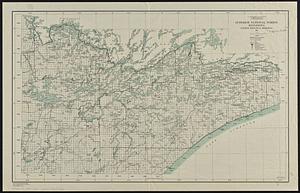
Superior National Forest, Minnesota, fourth principal meridian, 1928
8127.
Supplement pour les Isles Antilles, extrait des carte Angloises
8128.
Supplementary map to the "Daily Telegraph" war map no. 13
8129.
Surria : vernacule Surrey
8130.
Survey across the isthmus of Cape Cod, state of Massachusetts and town of Sandwich of a proposed canal between Buzzard's and...
8131.
[Survey of a property on the Boxford-Rowley line]
8132.
Survey of a valley and ponds auxiliary to a contemplated canal between Buzzard's & Barnstable Bays, state of Massachusetts and...
8133.
A survey of Lake Champlain, including Lake George, Crown Point, and St. John : surveyed by order of His Excellency...
8134.
A survey of the coast about Cape Lookout in North Carolina, taken the 29th. of June 1756
8135.
A survey of the empire group : with a complete distance table, a compendious index of cities and post offices, with populations...
8136.
A survey of the empire group : with a complete distance table, a compendious index of cities and post offices, with populations...
8137.
Survey of the harbor of Whitehall
8138.
A survey of the Mississippi River
8139.
Survey of the mouth of Trail Creek, Indiana
8140.
Suthsexia : vernacule Sussex
‹ Prev
Next ›
1
2
…
403
404
405
406
407
408
409
410
411
…
452
453


![[Survey of a property on the Boxford-Rowley line]](https://bpldcassets.blob.core.windows.net/derivatives/images/commonwealth:9s161g503/image_thumbnail_300.jpg)


