Toggle navigation
LMEC Home
Exhibitions
Georeferencing
Tools for Teachers
Collections
My Favorites
Sign Up / Log In
Search
Search the map portal
Map Collection
Map Collection
Map Sets
Search
Search
Search for
Search In
All Fields
Creator
Title
Subject
Place
Search All Digital Collections
Advanced Search
8722 Results
My Search
Start Over
More Like
commonwealth:6t053q10n
Remove constraint More Like: commonwealth:6t053q10n
Filter your Search
Place
North and Central America
5,953
United States
4,858
Massachusetts
2,080
Europe
1,396
Suffolk (county)
1,046
Boston
1,019
Canada
456
Asia
438
more
Place
»
Topic
Boston (Mass.)--Maps
586
United States--Maps
282
Real property--Massachusetts--Boston--Maps
175
Massachusetts--Maps
163
Landowners--Massachusetts--Boston--Maps
133
New England--Maps
106
North America--Maps--Early works to 1800
103
Europe--Maps
79
more
Topic
»
Date
Date range begin
–
Date range end
Current results range from
1482
to
2023
View distribution
Creator
United States. Hydrographic Office
595
O.H. Bailey & Co
148
Des Barres, Joseph F. W. (Joseph Frederick Wallet), 1722-1824
126
United States. Post Office Dept
120
Ptolemy, 2nd cent
100
Walling, Henry Francis, 1825-1888
94
Geological Survey (U.S.)
90
Jefferys, Thomas, -1771
85
more
Creator
»
Format
Maps/Atlases
8,662
Manuscripts
218
Prints
56
Books
36
Objects/Artifacts
10
Drawings/Illustrations
8
Posters
5
Georeferenced
Yes
870
No
7,852
Collection
Norman B. Leventhal Map & Education Center Collection
8,699
Boston and New England Maps
2,237
Urban Maps
2,023
Maritime Charts and Atlases
1,083
American Revolutionary War-Era Maps
636
Boston Redevelopment Authority Collection
87
American Antiquarian Society Collection
8
William L. Clements Library Collection
6
more
Collection
»
Available to use
No known restrictions
8,557
Creative Commons license
51
Search Constraints
Sort by relevance
relevance
title
date (asc)
date (desc)
Number of results to display per page
20 per page
10
per page
20
per page
50
per page
100
per page
View results as:
grid view
map view
Search Results
21.
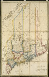
Map of the state of Maine : exhibiting the disputed territory in connexion with the adjacent British provinces of N. Brunswick...
22.
Map of the state of Maine
23.
A map of the state of Maine
24.
Map of the state of Maine with the province of New Brunswick
25.
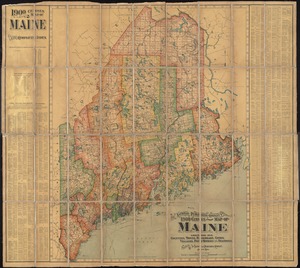
The National Publishing Company's 1900 census map of Maine : showing all counties, towns, railroads, cities, villages, post...
26.
New commercial, sportsmen's and route survey of Maine : showing all postoffices, railroads, electric roads, principal highways,...
27.
A new map of Maine
28.
North America : British provinces of New Brunswick, Nova Scotia, & part of Canada : compiled from recent surveys and adjusted...
29.
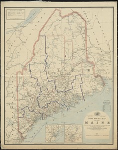
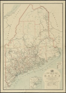
Post route map of the State of Maine showing post offices with the intermediate distances and mail routes in operation on the...
30.
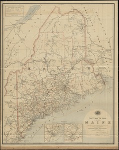
Post route map of the State of Maine showing post offices with the intermediate distances and mail routes in operation on the...
31.
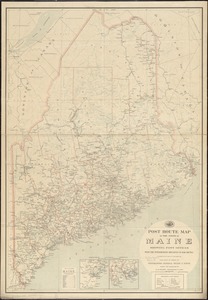
Post route map of the state of Maine showing post offices with the intermediate distances on mail routes in operation on the...
32.
Post route map of the state of Maine showing post offices with the intermediate distances on mail routes in operation on the...
33.
Province of Maine
34.
The province of Maine, from the best authorities
35.
Rand McNally official 1924 auto trails map Maine ; Rand McNally official 1924 auto trails map New Hampshire, Vermont
36.
Route and pictorial map of Maine
37.
State of Maine
38.
State of Maine
39.
The environs of Fort Cumberland in the Bay of Fundy
40.
Sketch A showing the progress of the survey in section no. 1 from 1844 to 1881
‹ Prev
Next ›
1
2
3
4
5
6
…
436
437