Toggle navigation
LMEC Home
Exhibitions
Georeferencing
Tools for Teachers
Collections
My Favorites
Sign Up / Log In
Search
Search the map portal
Map Collection
Map Collection
Map Sets
Search
Search
Search for
Search In
All Fields
Creator
Title
Subject
Place
Search All Digital Collections
Advanced Search
8834 Results
My Search
Start Over
More Like
commonwealth:6t053n91f
Remove constraint More Like: commonwealth:6t053n91f
Filter your Search
Place
North and Central America
6,010
United States
4,859
Massachusetts
2,079
Europe
1,396
Suffolk (county)
1,046
Boston
1,019
Canada
454
Asia
441
more
Place
»
Topic
Boston (Mass.)--Maps
586
United States--Maps
282
North America--Maps--Early works to 1800
240
Real property--Massachusetts--Boston--Maps
175
Massachusetts--Maps
162
Landowners--Massachusetts--Boston--Maps
133
New England--Maps
102
Europe--Maps
79
more
Topic
»
Date
Date range begin
–
Date range end
Current results range from
1482
to
2023
View distribution
Creator
United States. Hydrographic Office
595
O.H. Bailey & Co
148
Des Barres, Joseph F. W. (Joseph Frederick Wallet), 1722-1824
123
United States. Post Office Dept
120
Ptolemy, 2nd cent
100
Walling, Henry Francis, 1825-1888
94
Jefferys, Thomas, -1771
92
Sayer, Robert, 1725-1794
87
more
Creator
»
Format
Maps/Atlases
8,774
Manuscripts
217
Prints
56
Books
36
Objects/Artifacts
10
Drawings/Illustrations
8
Posters
5
Georeferenced
Yes
872
No
7,962
Collection
Norman B. Leventhal Map & Education Center Collection
8,704
Boston and New England Maps
2,234
Urban Maps
2,023
Maritime Charts and Atlases
1,083
American Revolutionary War-Era Maps
740
Boston Redevelopment Authority Collection
87
MacLean Collection Map Library
59
New York Public Library Collection
34
more
Collection
»
Available to use
No known restrictions
8,556
Creative Commons license
113
Search Constraints
Sort by relevance
relevance
title
date (asc)
date (desc)
Number of results to display per page
20 per page
10
per page
20
per page
50
per page
100
per page
View results as:
grid view
map view
Search Results
1.
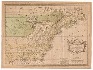
An accurate map of the British, French & Spanish settlements in Nth. America and the West Indies : as stipulated by the...
2.
A Map of the British and French settlements in North America : (part the second) containing part of New York, Pensilvania, New...
3.
A Map of the British and French settlements in North America
4.
A Map of the British and French settlements in North America
5.
North America from the French of Mr. D'Anville, improved with the back settlements of Virginia and course of Ohio, illustrated...
6.
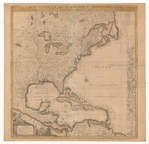
Carte du Canada ou de la Nouvelle France et des decouvertes qui y ont été faites
7.
Amérique septentrionale avec les routes, distances en miles, villages, et etablissements François et Anglois
8.
Carte nouvelle de l'Amérique Angloise contenant tout ce que les Anglois possédent sur le continent de l'Amérique...
9.
A New and correct map of the British colonies in North America comprehending eastern Canada with the province of Quebec, New...
10.
Nieuwe kaart van de Grootbrittannische volkplantingen in Noord America : waar in tevens de Fransche bezittingen en de Landen,...
11.
An accurate map of the British Empire in Nth. America as settled by the preliminaries in 1762
12.
An Accurate map of the present seat of war between Great-Britain and her colonies in North America
13.
Carte des possessions angloises & françoises du continent de l'Amérique Septentrionale = A map of the British and French...
14.
Carte générale de l'Amérique séptentrionale : avec les posséssions Angloises dans cette partie du nouveau monde
15.
Carte générale de l'Amérique séptentrionale avec les posséssions angloises dans cette partie du nouveau monde
16.
A new and accurate map of the English empire in North America : representing their rightful claim as confirm'd by charters, and...
17.
A new and correct map of North America with the West India Islands : divided according to the last treaty of peace, concluded...
18.
A new and correct map of North America; with the West India Islands : divided according to the last treaty of peace, concluded...
19.
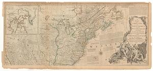
A general map of the middle British colonies in America, viz. Virginia, Maryland, Delaware, Pensilvania, New-Jersey, New York,...
20.
A Map of the British American plantations, extending from Boston in New England to Georgia : including all the back settlements...
‹ Prev
Next ›
1
2
3
4
5
…
441
442