Toggle navigation
LMEC Home
Exhibitions
Georeferencing
Tools for Teachers
Collections
My Favorites
Sign Up / Log In
Search
Search the map portal
Map Collection
Map Collection
Map Sets
Search
Search
Search for
Search In
All Fields
Creator
Title
Subject
Place
Search All Digital Collections
Advanced Search
8783 Results
My Search
Start Over
More Like
commonwealth:6h446r896
Remove constraint More Like: commonwealth:6h446r896
Filter your Search
Place
North and Central America
6,027
United States
4,947
Massachusetts
2,077
Europe
1,388
Suffolk (county)
1,184
Boston
1,157
Canada
449
Asia
436
more
Place
»
Topic
Boston (Mass.)--Maps
602
United States--Maps
279
Real property--Massachusetts--Boston--Maps
254
Landowners--Massachusetts--Boston--Maps
170
City planning--Massachusetts--Boston--Maps
164
Massachusetts--Maps
161
North America--Maps--Early works to 1800
103
New England--Maps
101
more
Topic
»
Date
Date range begin
–
Date range end
Current results range from
1482
to
2023
View distribution
Creator
United States. Hydrographic Office
595
Boston Redevelopment Authority
166
O.H. Bailey & Co
148
Des Barres, Joseph F. W. (Joseph Frederick Wallet), 1722-1824
123
United States. Post Office Dept
120
Ptolemy, 2nd cent
100
Walling, Henry Francis, 1825-1888
94
Geological Survey (U.S.)
86
more
Creator
»
Format
Maps/Atlases
8,724
Manuscripts
215
Prints
56
Books
36
Objects/Artifacts
10
Drawings/Illustrations
8
Posters
4
Georeferenced
Yes
870
No
7,913
Collection
Norman B. Leventhal Map & Education Center Collection
8,642
Boston and New England Maps
2,329
Urban Maps
2,093
Maritime Charts and Atlases
1,083
American Revolutionary War-Era Maps
616
Boston Redevelopment Authority Collection
193
Massachusetts Real Estate Atlases
35
Applied Geographics, Inc. Records
2
more
Collection
»
Available to use
No known restrictions
8,605
Creative Commons license
48
Search Constraints
Sort by relevance
relevance
title
date (asc)
date (desc)
Number of results to display per page
20 per page
10
per page
20
per page
50
per page
100
per page
View results as:
grid view
map view
Search Results
281.
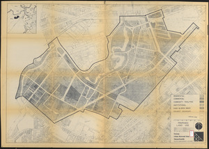
A rough and inaccurate sketch of the streets of Boston as they are supposed to have been first laid out & the owners of the...
282.
Rugby : belonging to Wood, Harmon & Co
283.
Tax parcels that would have been underwater in 1630
284.
Trustees' sale : beautiful building lots on Walnut St. and Walnut Avenue, in West Roxbury, containing about 3,126,519 square feet
285.
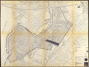
Fenway urban renewal area : major thoroughfares
286.
Fenway urban renewal area : blighted areas
287.
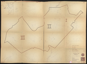
Fenway urban renewal area : locality map
288.
Fenway urban renewal area : existing land use
289.
Fenway urban renewal area : building conditions
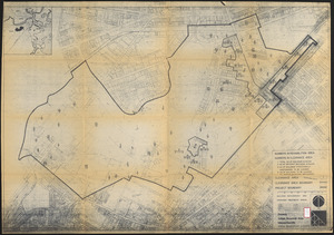
290.
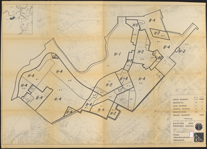
Fenway urban renewal area : treatment areas
291.
Fenway urban renewal area Massachusetts : building deficiences and proposed treatment area
292.
Fenway urban renewal area Massachusetts : existing and proposed zoning
293.
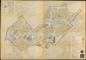
Fenway urban renewal area Massachusetts : existing land use
294.
Fenway urban renewal area Massachusetts : proposed land use
295.
Fenway urban renewal area Massachusetts : disposition parcels
296.
FPIR/FEIR Olmsted Plaza : a redevelopment of the Sears property, 309 Park Drive/201 Brookline Avenue in the Fenway
297.
Parker Hill-Fenway project no. Mass. R-48 : police signal system, fire alarm system and M.T.A. facilities
298.
Parker Hill-Fenway project no. Mass. R-48 : sewer and storm drain system
299.
Parker Hill-Fenway project no. Mass. R-48 : water distribution system
300.
Parker Hill-Fenway urban renewal area r-48 : building conditions
‹ Prev
Next ›
1
2
…
11
12
13
14
15
16
17
18
19
…
439
440