Toggle navigation
LMEC Home
Exhibitions
Georeferencing
Tools for Teachers
Collections
My Favorites
Sign Up / Log In
Search
Search the map portal
Map Collection
Map Collection
Map Sets
Search
Search
Search for
Search In
All Fields
Creator
Title
Subject
Place
Search All Digital Collections
Advanced Search
8695 Results
My Search
Start Over
More Like
commonwealth:4m90fn595
Remove constraint More Like: commonwealth:4m90fn595
Filter your Search
Place
North and Central America
5,926
United States
4,844
Massachusetts
2,079
Europe
1,396
Suffolk (county)
1,046
Boston
1,019
Canada
449
Asia
438
more
Place
»
Topic
Boston (Mass.)--Maps
586
United States--Maps
282
Real property--Massachusetts--Boston--Maps
175
Massachusetts--Maps
162
Landowners--Massachusetts--Boston--Maps
133
North America--Maps--Early works to 1800
103
New England--Maps
102
Europe--Maps
79
more
Topic
»
Date
Date range begin
–
Date range end
Current results range from
1482
to
2023
View distribution
Creator
United States. Hydrographic Office
595
O.H. Bailey & Co
148
Des Barres, Joseph F. W. (Joseph Frederick Wallet), 1722-1824
123
United States. Post Office Dept
120
Ptolemy, 2nd cent
100
Walling, Henry Francis, 1825-1888
94
Geological Survey (U.S.)
86
Jefferys, Thomas, -1771
85
more
Creator
»
Format
Maps/Atlases
8,634
Manuscripts
215
Prints
56
Books
37
Objects/Artifacts
10
Drawings/Illustrations
8
Posters
5
Georeferenced
Yes
869
No
7,826
Collection
Norman B. Leventhal Map & Education Center Collection
8,694
Boston and New England Maps
2,233
Urban Maps
2,023
Maritime Charts and Atlases
1,083
American Revolutionary War-Era Maps
616
Boston Redevelopment Authority Collection
87
U.S. Government Documents Maps Collection
1
Available to use
No known restrictions
8,553
Creative Commons license
47
Search Constraints
Sort by relevance
relevance
title
date (asc)
date (desc)
Number of results to display per page
20 per page
10
per page
20
per page
50
per page
100
per page
View results as:
grid view
map view
Search Results
41.
France et états limitrophes
42.
France, from the best authorities
43.
France kilométrique : carte indiquant les distances kilométriques sur tous les réseaux de chemins de fer
44.
Frankreich
45.
Hammond's five mile maps of western front
46.
Harper's war map of France
47.
Justus Perthes' übersichtskarte vom nordöstlichen Frankreich bis Paris &c
48.
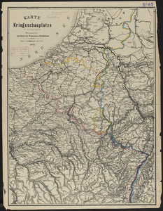
Karte vom kriegsschauplatze in autographie : herausgegeben zum besten der verwundeten u. hinterbliebenen
49.
Kriegs-karte 1870
50.
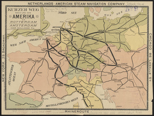
Kurzer weg nach und von Amerika via Rotterdam, Amsterdam oder Boulogne s/M
51.
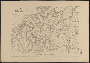
Map of the seat of war
52.
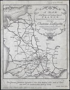
A map of the western and southern parts of France showing the motor routes and the principal cities on the way to Chateau...
53.
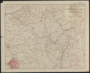
Military map of the theatre of war between France and Germany
54.
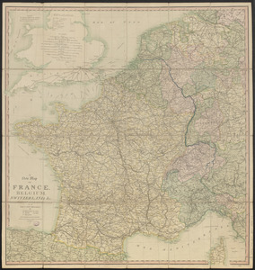
A new map of France, Belgium, Switzerland &c. : containing all the post & cross roads, with the rivers, & canals, also the old...
55.
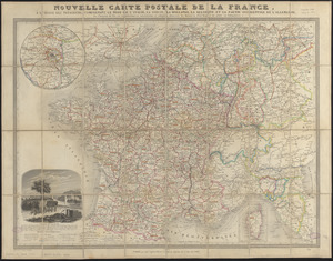
Nouvelle carte postale de la France, à l'usage des voyageurs, comprenant le nord de l'Italie, la Suisse, la Hollande, la...
56.
Philips' large scale contoured map of the Anglo-French front
57.
The picture map of France
58.
Specialkarte vom kriegsschauplatz am Rhein 1870 (Erfurt bis Paris) : Belgien, nordöstliches Frankreich, Luxembourg,...
59.
Tabulae maximae quibus illustrantur terrae veterum in usum scholarum
60.
Topographical map of the seat of the war
‹ Prev
Next ›
1
2
3
4
5
6
7
…
434
435