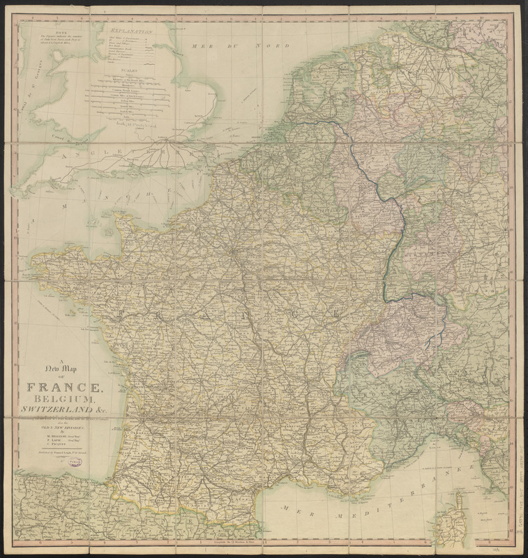
A new map of France, Belgium, Switzerland &c. : containing all the post & cross roads, with the rivers, & canals, also the old & new divisions
Item Information
- Title:
- A new map of France, Belgium, Switzerland &c. : containing all the post & cross roads, with the rivers, & canals, also the old & new divisions
- Cartographer:
- Belleyme, M.
- Cartographer:
- Picquet, Charles
- Cartographer:
- Lapie, M. (Pierre), 1779-1850
- Publisher:
- Leigh, Samuel
- Name on Item:
-
by M. Belleyme, P. Lapie, C. Picquet
- Date:
-
1825
- Format:
-
Maps/Atlases
- Location:
-
Boston Public Library
Norman B. Leventhal Map & Education Center - Collection (local):
-
Norman B. Leventhal Map & Education Center Collection
- Subjects:
-
France--Maps
Benelux countries--Maps
Switzerland--Maps
Germany (West)--Maps
- Places:
-
France
Belgium
Netherlands
Luxembourg
Switzerland
Germany
- Extent:
- 1 map : color, mounted on linen ; 78 x 74 cm, folded in slipcase 21 x 14 cm
- Terms of Use:
-
No known copyright restrictions.
No known restrictions on use.
- Publisher:
-
[London] :
Samuel Leigh
- Scale:
-
Scale approximately 1:1,830,000
- Language:
-
English
- Notes:
-
Prime meridian: Paris.
- Identifier:
-
06_01_016716
- Call #:
-
G5830 1825 .B45
- Barcode:
-
39999085951505