Toggle navigation
LMEC Home
Exhibitions
Georeferencing
Tools for Teachers
Collections
My Favorites
Sign Up / Log In
Search
Search the map portal
Map Collection
Map Collection
Map Sets
Search
Search
Search for
Search In
All Fields
Creator
Title
Subject
Place
Search All Digital Collections
Advanced Search
8803 Results
My Search
Start Over
More Like
commonwealth:4m90fd76c
Remove constraint More Like: commonwealth:4m90fd76c
Filter your Search
Place
North and Central America
6,034
United States
4,931
Massachusetts
2,153
Europe
1,396
Suffolk (county)
1,049
Boston
1,022
Canada
456
Asia
438
more
Place
»
Topic
Boston (Mass.)--Maps
592
United States--Maps
282
Massachusetts--Maps
235
Real property--Massachusetts--Boston--Maps
175
Landowners--Massachusetts--Boston--Maps
133
New England--Maps
127
North America--Maps--Early works to 1800
103
Europe--Maps
79
more
Topic
»
Date
Date range begin
–
Date range end
Current results range from
1482
to
2023
View distribution
Creator
United States. Hydrographic Office
595
O.H. Bailey & Co
148
Des Barres, Joseph F. W. (Joseph Frederick Wallet), 1722-1824
123
United States. Post Office Dept
120
Ptolemy, 2nd cent
100
Walling, Henry Francis, 1825-1888
95
Geological Survey (U.S.)
93
Jefferys, Thomas, -1771
86
more
Creator
»
Format
Maps/Atlases
8,742
Manuscripts
217
Prints
56
Books
36
Objects/Artifacts
10
Drawings/Illustrations
8
Posters
5
Ephemera
1
Georeferenced
Yes
881
No
7,922
Collection
Norman B. Leventhal Map & Education Center Collection
8,742
Boston and New England Maps
2,286
Urban Maps
2,024
Maritime Charts and Atlases
1,083
American Revolutionary War-Era Maps
660
Boston Redevelopment Authority Collection
90
David Judkins Weaver Papers
23
Applied Geographics, Inc. Records
20
more
Collection
»
Available to use
No known restrictions
8,600
Creative Commons license
54
Search Constraints
Sort by relevance
relevance
title
date (asc)
date (desc)
Number of results to display per page
20 per page
10
per page
20
per page
50
per page
100
per page
View results as:
grid view
map view
Search Results
301.
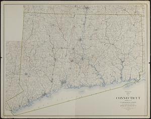
Connecticut from the best authorities
302.
Connecticut from the best authorities
303.
Map of Connecticut
304.
A new and correct map of Connecticut : one of the United States of North America
305.
Open space map of Connecticut, lands dedicated as open space, and selected undeveloped land, lands managed but not dedicated as...
306.
A particular discription of that part of the coast of Connecticut extending from Byram River to Stratford Point : these...
307.
Partie de l'état de Rhode-Island et position des armées Américaine et Britannique au siege de Newport et à l'affaire du 29 Août...
308.
The State of Rhode Island, : from the latest surveys. 1796
309.
Black in New England 1840
310.
Carte de la Nouvelle Angleterre, Nouvelle Yorck, et Pensilvanie. : Pour servir à l'Histoire générale des voyages
311.
Carte du theatre de la guerre presente en Amerique
312.
An Exact map of New England, New York, Pensylvania & New Jersey, : from the latest surveys
313.
An Exact map of the province of Quebec with part of New York & New England from the latest surveys
314.
L'Isle de Terre-Neuve, l'Acadie, ou la Nouvelle Ecosse, : l'Isle St. Jean et la partie orientale du Canada
315.
Krigs theatren i America = Seat of war in America
316.
A Map of New England & ye country adjacent, : extending northward to Quebec, & westward to Niagara, on Lake Ontario; shewing...
317.
A map of New England, and Nova Scotia; with part of New York, Canada, and New Britain & the adjacent islands of New Found Land...
318.
A Map of that part of America which was the principal seat of war in 1756
319.
A map of the coast of New England from Staten Island to the island of Breton
320.
A map of the most inhabited part of New England containing the provinces of Massachusets Bay and New Hampshire with the...
‹ Prev
Next ›
1
2
…
12
13
14
15
16
17
18
19
20
…
440
441