Toggle navigation
LMEC Home
Exhibitions
Georeferencing
Tools for Teachers
Collections
My Favorites
Sign Up / Log In
Search
Search the map portal
Map Collection
Map Collection
Map Sets
Search
Search
Search for
Search In
All Fields
Creator
Title
Subject
Place
Search All Digital Collections
Advanced Search
8729 Results
My Search
Start Over
More Like
commonwealth:3t948m167
Remove constraint More Like: commonwealth:3t948m167
Filter your Search
Place
North and Central America
5,960
United States
4,878
Massachusetts
2,113
Europe
1,396
Suffolk (county)
1,080
Boston
1,053
Canada
449
Asia
438
more
Place
»
Topic
Boston (Mass.)--Maps
586
United States--Maps
282
Real property--Massachusetts--Boston--Maps
182
Massachusetts--Maps
162
Landowners--Massachusetts--Boston--Maps
133
North America--Maps--Early works to 1800
103
New England--Maps
102
City planning--Massachusetts--Boston--Maps
101
more
Topic
»
Date
Date range begin
–
Date range end
Current results range from
1482
to
2023
View distribution
Creator
United States. Hydrographic Office
595
O.H. Bailey & Co
148
Des Barres, Joseph F. W. (Joseph Frederick Wallet), 1722-1824
123
United States. Post Office Dept
120
Boston Redevelopment Authority
105
Ptolemy, 2nd cent
100
Walling, Henry Francis, 1825-1888
94
Geological Survey (U.S.)
86
more
Creator
»
Format
Maps/Atlases
8,669
Manuscripts
215
Prints
56
Books
36
Objects/Artifacts
10
Drawings/Illustrations
8
Posters
5
Georeferenced
Yes
869
No
7,860
Collection
Norman B. Leventhal Map & Education Center Collection
8,694
Boston and New England Maps
2,267
Urban Maps
2,058
Maritime Charts and Atlases
1,083
American Revolutionary War-Era Maps
616
Boston Redevelopment Authority Collection
122
Available to use
No known restrictions
8,588
Creative Commons license
46
Search Constraints
Sort by relevance
relevance
title
date (asc)
date (desc)
Number of results to display per page
20 per page
10
per page
20
per page
50
per page
100
per page
View results as:
grid view
map view
Search Results
2421.
The game of the detectives
2422.
Gardner, Mass., 1880
2423.
Gardner's or Kemins Island, Phœnix Group ; Flint's Island ; McKeans Island, Phœnix Group ; Maro Reef ; Lahaina Roads, Island of...
2424.
Gas and water-supply in greater Tokyo - 1928
2425.
Gaspar Straits
2426.
Gastinois et Senonois
2427.
Gate 5 - Chelsea Street modified landscape scheme, Charlestown, MA
2428.
Gay days around America : a pleasure map of festivals, pageants, and special events best reached by Greyhound ... the...
2429.
Die gegend um Boston
2430.
Geldria ducatus, et Zutfania comitatus
2431.
Gen. Washington's Revolutionary campaign war map : after a survey ordered by him showing the position of his army in defence of...
2432.
Genealogical, chronological and geographical chart embracing Biblical and profane history of ancient times from Adam to Christ
2433.
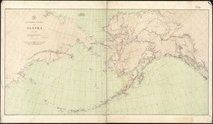
General chart of Alaska
2434.
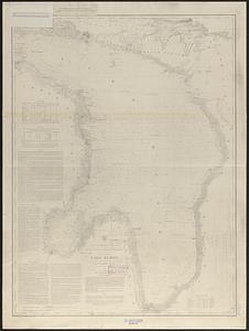
General chart of Lake Huron
2435.
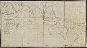
A general chart of the Indian and part of the Pacific Oceans, shewing the various passages to & from China, Australia, New...
2436.
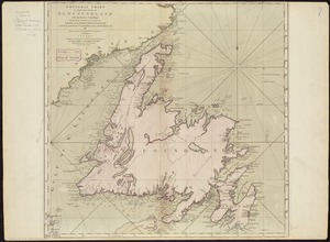
A general chart of the island of Newfoundland with the rocks & soundings
2437.
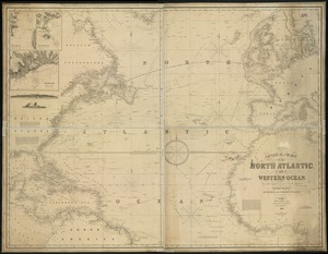
General chart, of the North Atlantic, or Western Ocean, from the equator to 62° north latitude, according to the latest,...
2438.
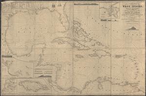
A general chart of the West Indies, including the Gulf of Mexico, with an enlarged plan of the island of Jamaica, also...
2439.
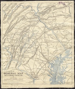
General map, Gettysburg-Antietam
2440.
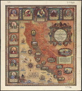
A general map of California during Spanish and Mexican occupation, 1542-1847
‹ Prev
Next ›
1
2
…
118
119
120
121
122
123
124
125
126
…
436
437