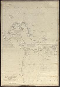
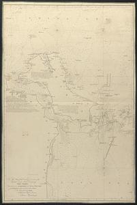
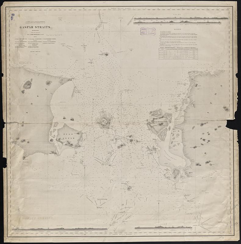
Gaspar Straits
Item Information
- Title:
- Gaspar Straits
- Cartographer:
- Knorr, E. R. (Ernest Rudolph)
- Draftsman:
- Mahon, Charles
- Artist:
- Kern, Edward Meyer, 1823-1863
- Issuing body:
- United States North Pacific Exploring Expedition (1853-1856)
- Name on Item:
-
surveyed under the command of Lieut. John Rodgers, U.S.N. by the U.S Stmr. John Hancock, U.S. Storeship J.P. Kennedy, U.S. Schr. Fenimore Cooper ; projected by E.R. Knorr ; reduced by C. Mahon ; views by Edwd. M. Kern
- Date:
-
[1854]
- Format:
-
Maps/Atlases
- Genre:
-
Nautical charts
- Location:
-
Boston Public Library
Norman B. Leventhal Map & Education Center - Collection (local):
-
Norman B. Leventhal Map & Education Center Collection
- Subjects:
-
Gelasa Strait (Indonesia)--Maps
Nautical charts--Indonesia--Gelasa Strait--Maps
- Places:
-
IndonesiaGelasa, Selat (strait)
- Extent:
- 1 map ; 85 x 83 cm
- Terms of Use:
-
No known copyright restrictions.
No known restrictions on use.
- Publisher:
-
[Washington, D.C.] :
U.S. North Pacific Surveying Expedition
- Scale:
-
Scale approximately 1:200,000
- Language:
-
English
- Notes:
-
Relief shown by hachures and spot heights. Depths shown by soundings.
"January to April 1894."
Includes notes, table of wind observations and 3 views.
- Notes (date):
-
This date is inferred.
- Identifier:
-
06_01_017546
- Call #:
-
G8072.G4P5 1854 .U55
- Barcode:
-
39999085960589