Toggle navigation
LMEC Home
Exhibitions
Georeferencing
Tools for Teachers
Collections
My Favorites
Sign Up / Log In
Search
Search the map portal
Map Collection
Map Collection
Map Sets
Search
Search
Search for
Search In
All Fields
Creator
Title
Subject
Place
Search All Digital Collections
Advanced Search
8943 Results
My Search
Start Over
More Like
commonwealth:3f463917s
Remove constraint More Like: commonwealth:3f463917s
Filter your Search
Place
North and Central America
6,174
United States
5,078
Massachusetts
2,206
Europe
1,396
Suffolk (county)
1,207
Boston
1,180
Canada
450
Asia
438
more
Place
»
Topic
Boston (Mass.)--Maps
752
United States--Maps
282
Massachusetts--Maps
235
Real property--Massachusetts--Boston--Maps
195
City planning--Massachusetts--Boston--Maps
157
Landowners--Massachusetts--Boston--Maps
142
New England--Maps
106
North America--Maps--Early works to 1800
103
more
Topic
»
Date
Date range begin
–
Date range end
Current results range from
1482
to
2023
View distribution
Creator
United States. Hydrographic Office
595
Boston Redevelopment Authority
162
O.H. Bailey & Co
148
Des Barres, Joseph F. W. (Joseph Frederick Wallet), 1722-1824
124
United States. Post Office Dept
120
Ptolemy, 2nd cent
100
Walling, Henry Francis, 1825-1888
95
Geological Survey (U.S.)
92
more
Creator
»
Format
Maps/Atlases
8,882
Manuscripts
219
Prints
56
Books
36
Objects/Artifacts
10
Drawings/Illustrations
8
Posters
5
Ephemera
1
Georeferenced
Yes
894
No
8,049
Collection
Norman B. Leventhal Map & Education Center Collection
8,765
Boston and New England Maps
2,404
Urban Maps
2,144
Maritime Charts and Atlases
1,083
American Revolutionary War-Era Maps
659
Boston Redevelopment Authority Collection
194
Applied Geographics, Inc. Records
22
Mapping Boston Collection
22
more
Collection
»
Available to use
No known restrictions
8,707
Creative Commons license
73
Search Constraints
Sort by relevance
relevance
title
date (asc)
date (desc)
Number of results to display per page
20 per page
10
per page
20
per page
50
per page
100
per page
View results as:
grid view
map view
Search Results
7861.
Special plans to chart no. 394, western shore of the Caribbean Sea : from British surveys, corrected to 1872
7862.
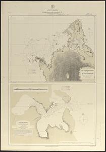
Special plans to chart no. 565 : harbors and anchorages on the N.W. coast of Madagascar : from British surveys in 1824,...
7863.
Special plans to chart no. 565, harbors and anchorages on the north coast of Madagascar : from British and French surveys,...
7864.
Specialkarte der Asiatischen Türkey : oestliches blatt
7865.
Special-karte der eisenbahn-, post- u. dampfschiff-verbindungen Mittel-Europa's mit angabe aller eisenbahn-, post- u....
7866.
Special-karte der Europäischen Türkey
7867.
Special-karte der Fränkischen Schweiz und der umgegend von Nürnberg : (aus Reymann's Special-karte von Central-Europa)
7868.
Specialkarte des Grossen Salzsee's von Utah und Seiner Umgebungen : nach den aufnahmen von Frémont und Stansbury
7869.
Specialkarte vom kriegsschauplatz am Rhein 1870 (Erfurt bis Paris) : Belgien, nordöstliches Frankreich, Luxembourg,...
7870.
Spencer
7871.
Spencer, Mass : 1877
7872.
Spencer, Massachusetts, 1892
7873.
Spezialkarte der Samoa-Inseln
7874.
Spezielle reise- und gebirgs-karte vom Lande Tyrol mit den angrenzenden theilen von Süd Bayern, Salzburg, der Schweiz,...
7875.
Spherical projection world
7876.
Sportsmen's fishing map of the United States and neighboring waters
7877.
Springfield, Ohio
7878.
Springfield, Vt
7879.
Springvale, Maine : looking west
7880.
Spry Harbour : Port Pallisser ; Port North ; Port Parker ; Beaver Harbour ; Fleming River
‹ Prev
Next ›
1
2
…
390
391
392
393
394
395
396
397
398
…
447
448