Toggle navigation
LMEC Home
Exhibitions
Georeferencing
Tools for Teachers
Collections
My Favorites
Sign Up / Log In
Search
Search the map portal
Map Collection
Map Collection
Map Sets
Search
Search
Search for
Search In
All Fields
Creator
Title
Subject
Place
Search All Digital Collections
Advanced Search
8609 Results
My Search
Start Over
More Like
commonwealth:3f4638304
Remove constraint More Like: commonwealth:3f4638304
Filter your Search
Place
North and Central America
5,894
United States
4,823
Massachusetts
2,056
Europe
1,359
Suffolk (county)
1,039
Boston
1,012
Canada
462
Asia
422
more
Place
»
Topic
Boston (Mass.)--Maps
581
United States--Maps
320
Real property--Massachusetts--Boston--Maps
175
Massachusetts--Maps
160
Landowners--Massachusetts--Boston--Maps
133
North America--Maps--Early works to 1800
103
New England--Maps
101
Europe--Maps
78
more
Topic
»
Date
Date range begin
–
Date range end
Current results range from
1482
to
2023
View distribution
Creator
United States. Hydrographic Office
594
O.H. Bailey & Co
148
Des Barres, Joseph F. W. (Joseph Frederick Wallet), 1722-1824
123
United States. Post Office Dept
120
Ptolemy, 2nd cent
100
Walling, Henry Francis, 1825-1888
94
Geological Survey (U.S.)
87
Jefferys, Thomas, -1771
85
more
Creator
»
Format
Maps/Atlases
8,550
Manuscripts
215
Prints
56
Books
36
Objects/Artifacts
10
Drawings/Illustrations
8
Posters
4
Georeferenced
Yes
871
No
7,738
Collection
Norman B. Leventhal Map & Education Center Collection
8,571
Boston and New England Maps
2,211
Urban Maps
1,941
Maritime Charts and Atlases
1,081
American Revolutionary War-Era Maps
651
Boston Redevelopment Authority Collection
88
American Antiquarian Society Collection
20
William L. Clements Library Collection
13
more
Collection
»
Available to use
No known restrictions
8,429
Creative Commons license
49
Search Constraints
Sort by relevance
relevance
title
date (asc)
date (desc)
Number of results to display per page
20 per page
10
per page
20
per page
50
per page
100
per page
View results as:
grid view
map view
Search Results
3381.
Lloyd's map of the lower Mississippi River from St. Louis to the Gulf of Mexico
3382.
Lloyd's map of the Southern States, showing all the railroads, their stations & distances : also the counties, towns, villages,...
3383.
Lloyd's new map of the Mississippi River from Cairo to its mouth
3384.
Lloyd's new military map of the border & southern states
3385.
Lloyd's new military map of the border & southern states
3386.
Lloyd's new military map of the border & southern states
3387.
Lloyd's new political chart, 1861 : with a map of the United States, showing the free states, border slave states, cotton...
3388.
Lloyd's official map of Missouri
3389.
Lloyd's official map of the state of Virginia from actual surveys by order of the Executive, 1828 & 1859
3390.
Lloyd's railroad, telegraph & express map of the Eastern States to accompany Lloyd's railroad, telegraph & express map of the...
3391.
Lloyd's telegraph, railroad & express map of the whole United States & Canadas, from official information
3392.
Localities of one thousand cases of intestinal diseases (diarrhoea, cholera-infantum & dysentery) in children, for the months...
3393.
The locality of the great struggle
3394.
Location of public open spaces
3395.
Lolo National Forest, Montana
3396.
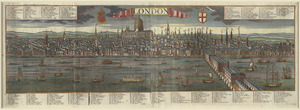
London
3397.
London : guide to the International Exhibition, 1862
3398.
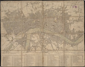
London
3399.
London
3400.
The London directory, or a new & improved plan of London, Westminster, & Southwark : with the adjacent country, the new...
‹ Prev
Next ›
1
2
…
166
167
168
169
170
171
172
173
174
…
430
431