Toggle navigation
LMEC Home
Exhibitions
Georeferencing
Tools for Teachers
Collections
My Favorites
Sign Up / Log In
Search
Search the map portal
Map Collection
Map Collection
Map Sets
Search
Search
Search for
Search In
All Fields
Creator
Title
Subject
Place
Search All Digital Collections
Advanced Search
8772 Results
My Search
Start Over
More Like
commonwealth:3f462x846
Remove constraint More Like: commonwealth:3f462x846
Filter your Search
Place
North and Central America
5,979
United States
4,917
Massachusetts
2,079
Europe
1,396
Suffolk (county)
1,046
Boston
1,019
Canada
469
Asia
438
more
Place
»
Topic
Boston (Mass.)--Maps
586
United States--Maps
282
Real property--Massachusetts--Boston--Maps
175
Massachusetts--Maps
162
Landowners--Massachusetts--Boston--Maps
133
North America--Maps--Early works to 1800
110
United States--Maps--Early works to 1800
103
New England--Maps
102
more
Topic
»
Date
Date range begin
–
Date range end
Current results range from
1482
to
2023
View distribution
Creator
United States. Hydrographic Office
595
O.H. Bailey & Co
148
Des Barres, Joseph F. W. (Joseph Frederick Wallet), 1722-1824
123
United States. Post Office Dept
120
Ptolemy, 2nd cent
100
Walling, Henry Francis, 1825-1888
94
Jefferys, Thomas, -1771
88
Geological Survey (U.S.)
86
more
Creator
»
Format
Maps/Atlases
8,712
Manuscripts
215
Prints
56
Books
36
Objects/Artifacts
10
Drawings/Illustrations
8
Posters
5
Georeferenced
Yes
872
No
7,900
Collection
Norman B. Leventhal Map & Education Center Collection
8,696
Boston and New England Maps
2,233
Urban Maps
2,023
Maritime Charts and Atlases
1,083
American Revolutionary War-Era Maps
692
Boston Redevelopment Authority Collection
87
MacLean Collection Map Library
43
New York Public Library Collection
15
more
Collection
»
Available to use
No known restrictions
8,556
Creative Commons license
76
Search Constraints
Sort by relevance
relevance
title
date (asc)
date (desc)
Number of results to display per page
20 per page
10
per page
20
per page
50
per page
100
per page
View results as:
grid view
map view
Search Results
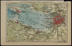
7701.
St. Petersburg und umgebung
7702.
St. Stephen, New Brunswick and Calais, Maine : 1889
7703.
St. Thomas, Province, Ontario Canada, 1875
7704.
St. Vincent, from an actual survey made in the year 1773 : after the treaty with the Caribs
7705.
Staaten am Atlantischen Ocean
7706.
Stamford, Conn
7707.
Standard railway map of South Africa = Standaard spoorwegkaart van Suidafrika
7708.
Standard Russo-Japanese war map July 1904
7709.
Stanford's enlarged map of the seat of war
7710.
Stanford's library map of the world on Mercator's projection
7711.
Stanford's military map of the seat of war
7712.
Stanford's shilling map of the seat of war
7713.
Stannard & Son's, panoramic birds-eye view, of Berlin & its defences, the principal Prussian ports on the Baltic, with Denmark...
7714.
Stannard & Son's, panoramic birds-eye view of France & Prussia and the surrounding countries likely to be involved in the War,...
7715.
Stannard & Son's, panoramic birds-eye view of the French & Prussian provinces, on the banks of the Rhine, shewing all the...
7716.
Stannard & Son's, perspective view, of the immediate seat of war & recent battle fields, shewing all the fortifications and...
7717.
State of Alabama
7718.
State of Arkansas
7719.
State of California
7720.
State of Chiapas
‹ Prev
Next ›
1
2
…
382
383
384
385
386
387
388
389
390
…
438
439