Toggle navigation
LMEC Home
Exhibitions
Georeferencing
Tools for Teachers
Collections
My Favorites
Sign Up / Log In
Search
Search the map portal
Map Collection
Map Collection
Map Sets
Search
Search
Search for
Search In
All Fields
Creator
Title
Subject
Place
Search All Digital Collections
Advanced Search
197 Results
My Search
Start Over
More Like
commonwealth:3f462s523
Remove constraint More Like: commonwealth:3f462s523
Filter your Search
Place
North and Central America
107
United States
79
World
63
Boston
44
Suffolk (county)
43
New England
30
Boston Harbor
28
Massachusetts
10
more
Place
»
Topic
World maps--Early works to 1800
76
New England--Maps--Early works to 1800
23
Boston (Mass.)--Maps
20
Boston (Mass.)--History--Revolution, 1775-1783--Maps--Early works to 1800
16
Boston Harbor (Mass.)--Maps--Early works to 1800
13
Boston Harbor (Mass.)--Maps
10
Fortification--Massachusetts--Boston--Maps--Early works to 1800
10
North America--Maps--Early works to 1800
9
more
Topic
»
Date
Date range begin
–
Date range end
Current results range from
1488
to
1927
View distribution
Creator
Page, Thomas Hyde, Sir, 1746-1821
7
United States Coast Survey
6
Southack, Cyprian, 1662-1745
5
Bache, A. D. (Alexander Dallas), 1806-1867
4
Bellin, Jacques Nicolas, 1703-1772
4
Des Barres, Joseph F. W. (Joseph Frederick Wallet), 1722-1824
4
Faden, William, 1749-1836
4
Moll, Herman, d. 1732
4
more
Creator
»
Format
Maps/Atlases
196
Manuscripts
2
Prints
1
Georeferenced
Yes
29
No
168
Collection
Norman B. Leventhal Map Center Collection
184
Mapping Boston Collection
139
Boston and New England Maps
73
American Revolutionary War-Era Maps
38
Maritime Charts and Atlases
28
Urban Maps
23
Sidney R. Knafel Map Collection at Phillips Academy
13
Available to use
Creative Commons license
137
No known restrictions
47
Search Constraints
Sort by date (desc)
relevance
title
date (asc)
date (desc)
Number of results to display per page
20 per page
10
per page
20
per page
50
per page
100
per page
View results as:
grid view
map view
Search Results
61.
The world with all modern discoveries
62.
Boston, its environs and harbour, with the rebels works raised against that town in 1775
63.
Partie septentrionale des possessions Angloise en Amerique : pour servire d'intelligence à la guerre présente entre les...
64.
Plan de Boston avec les sondes et les directions pour la navigation : traduit de l'anglais
65.
A plan of the action at Bunkers Hill, on the 17th. of June, 1775 : between His Majesty's troops under the command of Major...
66.
A plan of the action at Bunkers Hill, on the 17th. of June, 1775 : between His Majesty's troops under the command of Major...
67.
Carta della Nuova Inghilterra, Nuova Iork, e Pensilvania
68.
A plan of Boston in New England with its environs : including Milton, Dorchester, Roxbury, Brooklin, Cambridge, Medford,...
69.
A plan of the town of Boston, with the intrenchments &c. of His Majestys forces in 1775 : from the observations of Lieut. Page...
70.
Bowles's new pocket map of the most inhabited part of New England : comprehending the provinces of Massachusets Bay and New...
71.
Carte du port et havre de Boston avec les côtes adjacentes, dans laquel on a tracée les camps et les retranchemens occupé,...
72.
Carte von dem Hafen und der Stadt Boston : mit den umliegenden Gegenden und der Lägern sowohl der Americaner als auch des...
73.
A chart of Boston Bay and vicinity
74.
Chart of the track of the Dolphin, Tamar, Swallow & Endeavour through the South Seas ; & of the track of M. Bougainville round...
75.
A plan of Boston, and its environs : shewing the true situation of His Majesty's army, and also those of the rebels
76.
A chart of the world upon Mercator's projection : describing the tracks of Capt. Cook in the year 1768, 69, 70, 71, and in...
77.
Exact plan of General Gage's lines on Boston Neck in America
78.
Map of the environs of Boston
79.
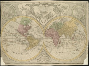
Mappa totius mundi : adornata juxta observationes dnn. academiae regalis scientiarum et nonnullorum aliorum secundum...
80.
A new and correct plan of the town of Boston
‹ Prev
Next ›
1
2
3
4
5
6
7
8
9
10