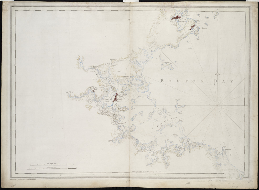
A chart of Boston Bay and vicinity
Item Information
- Title:
- A chart of Boston Bay and vicinity
- Description:
-
While a few of the charts in Des Barress Atlantic Neptune featured long stretches of the coast line , many focused on specific localities, such as this chart of Boston Bay. This is the earliest issue of Des Barres fine chart of the Bay. This chart also serves as an example of how the exigencies of war contributed to the history of American cartography as often as trade or discovery. Commissioned by the British Admiralty for military use, Des Barrescharts were the most dependable charts at the outset of the American Revolution.
- Creator:
- Des Barres, Joseph F. W. (Joseph Frederick Wallet), 1722-1824
- Date:
-
1776
- Format:
-
Maps/Atlases
- Location:
- Private Collection
- Collection (local):
-
Mapping Boston Collection
- Subjects:
-
Nautical charts--Massachusetts--Boston Bay--Early works to 1800
Boston Bay (Mass.)--Maps--Early works to 1800
- Places:
-
MassachusettsBoston Harbor
- Extent:
- 1 chart ; 76 x 106 cm.
- Terms of Use:
-
No known copyright restrictions.
This work is licensed for use under a Creative Commons Attribution Non-Commercial Share Alike License (CC BY-NC-SA).

- Publisher:
-
[London] :
J.F.W. Des Barres
- Scale:
-
Scale [ca. 1:50,000]
- Language:
-
English
- Notes:
-
Relief shown by hachures. Depths shown by soundings.
Appears in the author's Atlantic Neptune. London : J.F.W. Des Barres, 1777-[1781].
- Identifier:
-
06_01_001200
- Barcode:
-
39999052508437


![[A chart of Boston Bay and vicinity]](https://bpldcassets.blob.core.windows.net/derivatives/images/commonwealth:cj82m2976/image_thumbnail_300.jpg)

