Toggle navigation
LMEC Home
Exhibitions
Georeferencing
Tools for Teachers
Collections
My Favorites
Sign Up / Log In
Search
Search the map portal
Map Collection
Map Collection
Map Sets
Search
Search
Search for
Search In
All Fields
Creator
Title
Subject
Place
Search All Digital Collections
Advanced Search
8720 Results
My Search
Start Over
More Like
commonwealth:2514p078d
Remove constraint More Like: commonwealth:2514p078d
Filter your Search
Place
North and Central America
5,927
United States
4,844
Massachusetts
2,079
Europe
1,396
Suffolk (county)
1,046
Boston
1,019
Canada
449
Asia
439
more
Place
»
Topic
Boston (Mass.)--Maps
586
United States--Maps
282
Real property--Massachusetts--Boston--Maps
175
Massachusetts--Maps
162
Landowners--Massachusetts--Boston--Maps
133
North America--Maps--Early works to 1800
104
New England--Maps
102
Europe--Maps
79
more
Topic
»
Date
Date range begin
–
Date range end
Current results range from
1482
to
2023
View distribution
Creator
United States. Hydrographic Office
595
O.H. Bailey & Co
148
Des Barres, Joseph F. W. (Joseph Frederick Wallet), 1722-1824
123
United States. Post Office Dept
120
Ptolemy, 2nd cent
100
Walling, Henry Francis, 1825-1888
94
Geological Survey (U.S.)
86
Jefferys, Thomas, -1771
86
more
Creator
»
Format
Maps/Atlases
8,660
Manuscripts
215
Prints
56
Books
36
Objects/Artifacts
10
Drawings/Illustrations
8
Posters
5
Georeferenced
Yes
869
No
7,851
Collection
Norman B. Leventhal Map & Education Center Collection
8,697
Boston and New England Maps
2,233
Urban Maps
2,023
Maritime Charts and Atlases
1,083
American Revolutionary War-Era Maps
629
Boston Redevelopment Authority Collection
87
Sidney R. Knafel Map Collection at Phillips Academy
10
MacLean Collection Map Library
6
more
Collection
»
Available to use
No known restrictions
8,552
Creative Commons license
57
Search Constraints
Sort by relevance
relevance
title
date (asc)
date (desc)
Number of results to display per page
20 per page
10
per page
20
per page
50
per page
100
per page
View results as:
grid view
map view
Search Results
3221.
Lloyd's military maps : showing the principal places of interest
3222.
Lloyd's new county map of the United States and Canadas showing battle fields, railroads, &c., compiled from the latest...
3223.
Lloyd's new map of the Mississippi River from Cairo to its mouth
3224.
Lloyd's new map of the United States, the Canadas, and New Brunswick, from the latest surveys showing every railroad & station...
3225.
Lloyd's new military map of the border & southern states
3226.
Lloyd's new military map of the border & southern states
3227.
Lloyd's new military map of the border & southern states
3228.
Lloyd's new political chart, 1861 : with a map of the United States, showing the free states, border slave states, cotton...
3229.
Lloyd's official map of Missouri
3230.
Lloyd's official map of the state of Virginia from actual surveys by order of the Executive, 1828 & 1859
3231.
Lloyd's railroad, telegraph & express map of the Eastern States to accompany Lloyd's railroad, telegraph & express map of the...
3232.
Lloyd's telegraph, railroad & express map of the whole United States & Canadas, from official information
3233.
Localities of one thousand cases of intestinal diseases (diarrhoea, cholera-infantum & dysentery) in children, for the months...
3234.
The locality of the great struggle
3235.
Location of public open spaces
3236.
Lolo National Forest, Montana
3237.
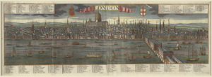
London
3238.
London : guide to the International Exhibition, 1862
3239.
London
3240.
London
‹ Prev
Next ›
1
2
…
158
159
160
161
162
163
164
165
166
…
435
436