Toggle navigation
LMEC Home
Exhibitions
Georeferencing
Tools for Teachers
Collections
My Favorites
Sign Up / Log In
Search
Search the map portal
Map Collection
Map Collection
Map Sets
Search
Search
Search for
Search In
All Fields
Creator
Title
Subject
Place
Search All Digital Collections
Advanced Search
8933 Results
My Search
Start Over
More Like
commonwealth:1257c153s
Remove constraint More Like: commonwealth:1257c153s
Filter your Search
Place
North and Central America
6,164
United States
5,080
Massachusetts
2,145
Europe
1,396
Suffolk (county)
1,279
Boston
1,252
Canada
449
Asia
438
more
Place
»
Topic
Boston (Mass.)--Maps
753
United States--Maps
282
Real property--Massachusetts--Boston--Maps
254
City planning--Massachusetts--Boston--Maps
197
Landowners--Massachusetts--Boston--Maps
170
Massachusetts--Maps
166
Urban renewal--Massachusetts--Boston--Maps
105
New England--Maps
104
more
Topic
»
Date
Date range begin
–
Date range end
Current results range from
1482
to
2023
View distribution
Creator
United States. Hydrographic Office
595
Boston Redevelopment Authority
200
O.H. Bailey & Co
148
Des Barres, Joseph F. W. (Joseph Frederick Wallet), 1722-1824
124
United States. Post Office Dept
120
Ptolemy, 2nd cent
100
Walling, Henry Francis, 1825-1888
94
Geological Survey (U.S.)
87
more
Creator
»
Format
Maps/Atlases
8,873
Manuscripts
215
Prints
56
Books
36
Objects/Artifacts
10
Drawings/Illustrations
8
Posters
5
Georeferenced
Yes
886
No
8,047
Collection
Norman B. Leventhal Map & Education Center Collection
8,725
Boston and New England Maps
2,403
Urban Maps
2,187
Maritime Charts and Atlases
1,083
American Revolutionary War-Era Maps
638
Boston Redevelopment Authority Collection
235
Massachusetts Real Estate Atlases
38
Mapping Boston Collection
20
more
Collection
»
Available to use
No known restrictions
8,710
Creative Commons license
70
Search Constraints
Sort by relevance
relevance
title
date (asc)
date (desc)
Number of results to display per page
20 per page
10
per page
20
per page
50
per page
100
per page
View results as:
grid view
map view
Search Results
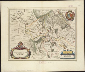
7821.
Les Souverainetez de Sedan et Raucourt et la Prevosté de Doncheri
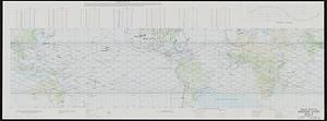
7822.
Space shuttle mission chart STS-7
7823.
La Spagnuola
7824.
Spagnvola
7825.
Spagnvola
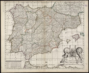
7826.
Spain & Portugal
7827.
Spain and Portugal
7828.
Spain and Portugal
7829.
Spain and Portugal
7830.
Spain and Portugal from the best authorities
7831.
Spain and Portugal, from the best authorities
7832.
The Spainish Netherlands, vulgarly called Flanders, devided into its X provinces, wherein are delineated the fortified towns...
7833.
Spain--south coast, Port Málaga : from the Spanish government survey of 1872
7834.
Spain--west coast, Arosa and Pontevedra Bays : from the latest Spanish surveys : republication of Brit. Admty. chart no. 1756
7835.
Spanish North America
7836.
Spanish North America, southern part
7837.
Spartanburg, South Carolina : the city of success ; city map and street directory
7838.
Special map of Rossland, British Columbia
7839.
Special plan to chart no. 565 : harbors and anchorages on the N.E. coast of Madagascar : from British and French surveys,...
7840.
Special plans to chart no. 318
‹ Prev
Next ›
1
2
…
388
389
390
391
392
393
394
395
396
…
446
447