Toggle navigation
LMEC Home
Exhibitions
Georeferencing
Tools for Teachers
Collections
My Favorites
Sign Up / Log In
Search
Search the map portal
Map Collection
Map Collection
Map Sets
Search
Search
Search for
Search In
All Fields
Creator
Title
Subject
Place
Search All Digital Collections
Advanced Search
8801 Results
My Search
Start Over
More Like
commonwealth:1257bt91s
Remove constraint More Like: commonwealth:1257bt91s
Filter your Search
Place
North and Central America
6,096
United States
5,018
Massachusetts
2,136
Europe
1,359
Suffolk (county)
1,281
Boston
1,254
Canada
448
Asia
422
more
Place
»
Topic
Boston (Mass.)--Maps
741
United States--Maps
273
Real property--Massachusetts--Boston--Maps
252
City planning--Massachusetts--Boston--Maps
211
Landowners--Massachusetts--Boston--Maps
169
Massachusetts--Maps
163
Urban renewal--Massachusetts--Boston--Maps
118
North America--Maps--Early works to 1800
103
more
Topic
»
Date
Date range begin
–
Date range end
Current results range from
1482
to
2023
View distribution
Creator
United States. Hydrographic Office
594
Boston Redevelopment Authority
215
O.H. Bailey & Co
148
Des Barres, Joseph F. W. (Joseph Frederick Wallet), 1722-1824
124
United States. Post Office Dept
120
Ptolemy, 2nd cent
100
Walling, Henry Francis, 1825-1888
94
Geological Survey (U.S.)
87
more
Creator
»
Format
Maps/Atlases
8,741
Manuscripts
215
Prints
56
Books
36
Objects/Artifacts
10
Drawings/Illustrations
9
Posters
4
Georeferenced
Yes
885
No
7,916
Collection
Norman B. Leventhal Map & Education Center Collection
8,577
Boston and New England Maps
2,384
Urban Maps
2,112
Maritime Charts and Atlases
1,081
American Revolutionary War-Era Maps
642
Boston Redevelopment Authority Collection
248
Massachusetts Real Estate Atlases
38
Mapping Boston Collection
21
more
Collection
»
Available to use
No known restrictions
8,575
Creative Commons license
70
Search Constraints
Sort by relevance
relevance
title
date (asc)
date (desc)
Number of results to display per page
20 per page
10
per page
20
per page
50
per page
100
per page
View results as:
grid view
map view
Search Results
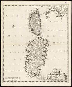
3541.
Insularum Sardiniae et Corsicae
3542.
Insurance map of Boston vol. 3 (South & East Boston)
3543.
Insurance map of Chicago, 1868-9
3544.
Insurance maps of Gloucester, Massachusetts
3545.
Insurance maps of Malden, Middlesex Co., Massachusetts
3546.
Insurance maps of the city of New York
3547.
Insurance maps of Ware, Hampshire County, Massachusetts
3548.
Interlaken und umgebung : nach der dufourkarte und dem kataster bearbeitet durch Emil Hodler, ingenieur
3549.
International map of the world on the scale 1:1,000,000
3550.
Internum mare seu Mediterranæum Strabonis
3551.
Invasion and total war victory maps : with decorations, illustrations and military and naval insignia
3552.
Iowa County, Wis.
3553.
Ipswich and Annisquam harbors, Massachusetts [archaeology in 1874]
3554.
Ipswich, Mass : incorporated 1634
3555.
Iraq
3556.
Iraq water supply and land use
3557.
Ireland : from the best authorities, with the distances laid down in British statute miles
3558.
Ireland
3559.
Ireland
3560.
Ireland
‹ Prev
Next ›
1
2
…
174
175
176
177
178
179
180
181
182
…
440
441


![Ipswich and Annisquam harbors, Massachusetts [archaeology in 1874]](https://bpldcassets.blob.core.windows.net/derivatives/images/commonwealth:2f75vg12c/image_thumbnail_300.jpg)


