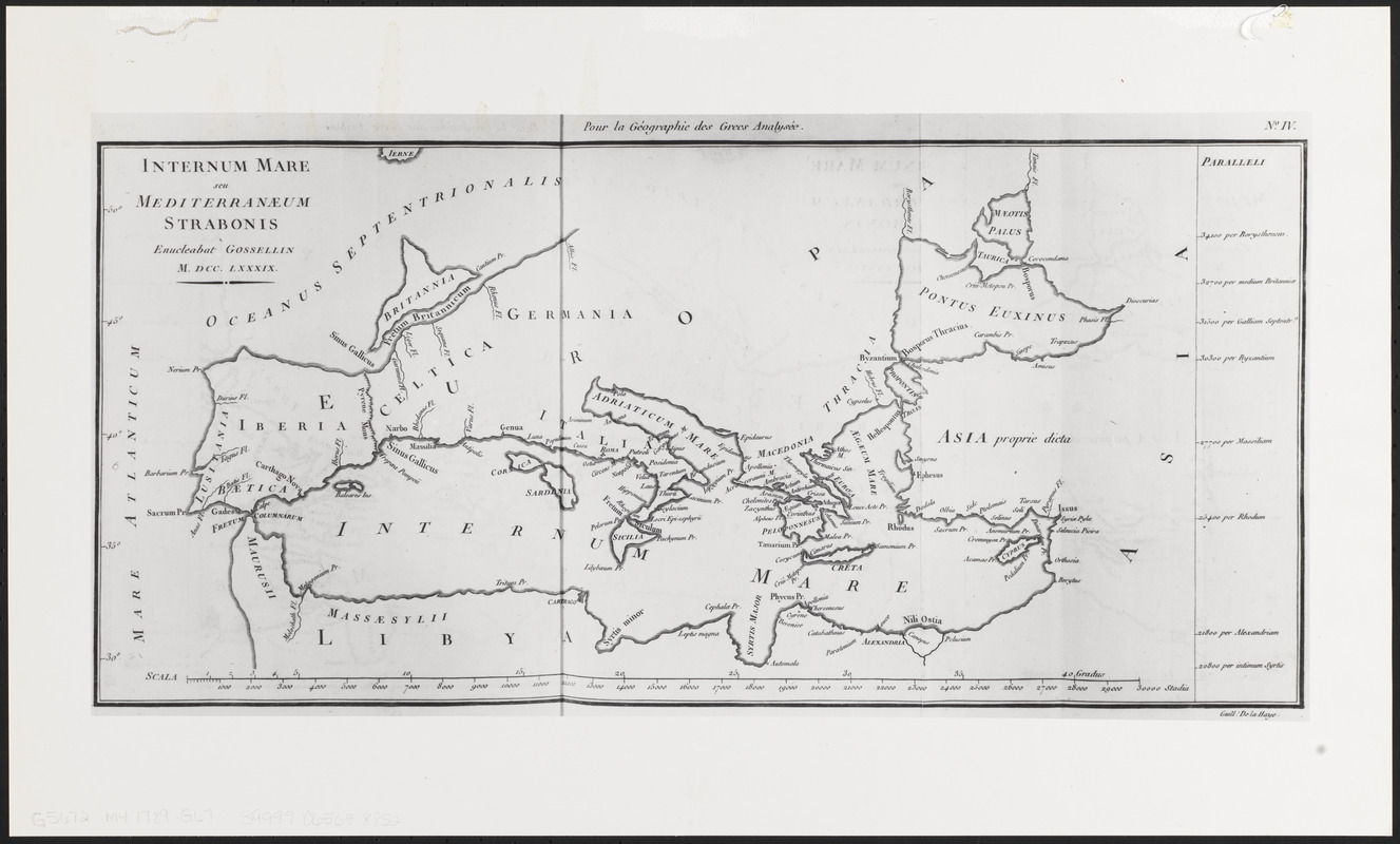
Internum mare seu Mediterranæum Strabonis
Item Information
- Title:
- Internum mare seu Mediterranæum Strabonis
- Cartographer:
- Gossellin, Pascal-François-Joseph, 1751-1830
- Engraver:
- Haye, G. de la
- Name on Item:
-
enucleabat Gossellin ; Guill. de la Haye
- Date:
-
[1789]
- Format:
-
Maps/Atlases
- Location:
-
Boston Public Library
Norman B. Leventhal Map & Education Center - Collection (local):
-
Norman B. Leventhal Map & Education Center Collection
- Subjects:
-
Mediterranean Sea--Maps
- Places:
-
Mediterranean Sea
- Extent:
- 1 map ; 21 x 44 cm
- Terms of Use:
-
No known copyright restrictions.
No known restrictions on use.
- Publisher:
-
[Paris] :
[Didot l'aîné]
- Scale:
-
Scale approximately 1:12,500,000
- Language:
-
Latin
- Notes:
-
Photocopied from Gossellin's Géographie des Grecs analysée.
"Pour la Géographie des Grecs analysée."
"No. IV."
- Notes (date):
-
This date is inferred.
- Identifier:
-
06_01_012680
- Call #:
-
G5672.M4 1789 .G67
- Barcode:
-
39999065698852