Toggle navigation
LMEC Home
Exhibitions
Georeferencing
Tools for Teachers
Collections
My Favorites
Sign Up / Log In
Search
Search the map portal
Map Collection
Map Collection
Map Sets
Search
Search
Search for
Search In
All Fields
Creator
Title
Subject
Place
Search All Digital Collections
Advanced Search
8701 Results
My Search
Start Over
More Like
commonwealth:1257bb16b
Remove constraint More Like: commonwealth:1257bb16b
Filter your Search
Place
North and Central America
5,932
United States
4,850
Massachusetts
2,081
Europe
1,396
Suffolk (county)
1,050
Boston
1,024
Canada
449
Asia
438
more
Place
»
Topic
Boston (Mass.)--Maps
588
United States--Maps
282
Real property--Massachusetts--Boston--Maps
175
Massachusetts--Maps
162
Landowners--Massachusetts--Boston--Maps
133
North America--Maps--Early works to 1800
103
New England--Maps
102
Europe--Maps
79
more
Topic
»
Date
Date range begin
–
Date range end
Current results range from
1482
to
2023
View distribution
Creator
United States. Hydrographic Office
595
O.H. Bailey & Co
148
Des Barres, Joseph F. W. (Joseph Frederick Wallet), 1722-1824
123
United States. Post Office Dept
120
Ptolemy, 2nd cent
100
Walling, Henry Francis, 1825-1888
94
Geological Survey (U.S.)
86
Jefferys, Thomas, -1771
85
more
Creator
»
Format
Maps/Atlases
8,641
Manuscripts
215
Prints
56
Books
36
Objects/Artifacts
10
Drawings/Illustrations
8
Posters
5
Georeferenced
Yes
870
No
7,831
Collection
Norman B. Leventhal Map & Education Center Collection
8,697
Boston and New England Maps
2,238
Urban Maps
2,027
Maritime Charts and Atlases
1,083
American Revolutionary War-Era Maps
617
Boston Redevelopment Authority Collection
90
Applied Geographics, Inc. Records
1
David Judkins Weaver Papers
1
more
Collection
»
Available to use
No known restrictions
8,557
Creative Commons license
49
Search Constraints
Sort by relevance
relevance
title
date (asc)
date (desc)
Number of results to display per page
20 per page
10
per page
20
per page
50
per page
100
per page
View results as:
grid view
map view
Search Results
21.
[Character conversion print errors on] Draft working map Neponset River estuary
22.
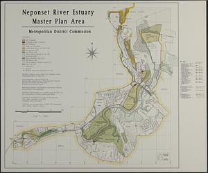
Neponset River estuary master plan area
23.
Map of Dorchester Mass
24.
Plan no II of land of George D. Welles situated in ward 16 Boston
25.
[Plan of house lots for sale on Savin Hill Avenue, Dorchester, Mass.]
26.
Plan of house lots in ward 16 : owned by Saml. B. Pierce & Geo. C. Ludington, Boston, near the Dorchester Station, Norfolk...
27.
Plan of land belonging to J.M. & G.H. Pike : ward 16 - Boston
28.
Plan of land owned by the heirs of Frederick Clapp
29.
Plan of lots on Mount-Bowdoin in Dorchester
30.
Plan of real estate belonging to T.W. & J.H. Cox : situated in ward 16, Boston
31.
[Plan of the cove between Savin Hill and Commercial Point, Dorchester]
32.
Plat of lots in Boston (Dorchester Dist.) belonging to B.P. Cunningham
33.
Woodland Cemetery in Dorchester and Roxbury main entrance on Walk-Hill Street : five miles from Boylston market, direct route...
34.
Boston Harbor : challenges and opportunities for the 1980's
35.
Plan for the occupation of flats owned by the Commonwealth in Boston Harbor
36.
Port facilities at Boston, MA
37.
Various plans and draughts of cities, towns, harbours &c
38.
The 100th anniversary map of Abraham Lincoln's visit to Massachusetts, September 11-23, 1848
39.
1630 shoreline
40.
1879. Progress map of the U.S. Geographical Surveys west of the 100th Meridian : prepared under the direction of 1st Lieut....
‹ Prev
Next ›
1
2
3
4
5
6
…
435
436
![[Character conversion print errors on] Draft working map Neponset River estuary](https://bpldcassets.blob.core.windows.net/derivatives/images/commonwealth:mc87v2589/image_thumbnail_300.jpg)


![[Plan of house lots for sale on Savin Hill Avenue, Dorchester, Mass.]](https://bpldcassets.blob.core.windows.net/derivatives/images/commonwealth:9s161f68b/image_thumbnail_300.jpg)


![[Plan of the cove between Savin Hill and Commercial Point, Dorchester]](https://bpldcassets.blob.core.windows.net/derivatives/images/commonwealth:js956k66d/image_thumbnail_300.jpg)


