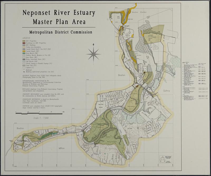
Neponset River estuary master plan area
Item Information
- Title:
- Neponset River estuary master plan area
- Cartographer:
- Applied Geographics, Inc.
- Contributor:
- Massachusetts. Metropolitan District Commission
- Name on Item:
-
Metropolitan District Commission ; Applied Geographics
- Date:
-
[1994–1996]
- Format:
-
Maps/Atlases
- Location:
-
Boston Public Library
Norman B. Leventhal Map & Education Center - Collection (local):
-
Applied Geographics, Inc. Records
- Subjects:
-
Neponset River (Mass.)--Maps
Land cover--Massachusetts--Neponset River--Maps
- Places:
-
MassachusettsNeponset (river)
- Extent:
- 1 maps : color, plastic-coated ; 83 x 87 cm
- Terms of Use:
-
No known copyright restrictions.
No known restrictions on use.
- Publisher:
-
Boston :
Applied Geographics, Inc.
- Scale:
-
Scale 1:7,000
- Language:
-
English
- Notes:
-
Relief shown by contours.
- Notes (date):
-
This date is inferred.
- Identifier:
-
06_01_018914
- Call #:
-
AppGeo Folder 3 no. 15
- Barcode:
-
30000008056472
![[Character conversion print errors on] Draft working map Neponset River estuary](https://bpldcassets.blob.core.windows.net/derivatives/images/commonwealth:mc87v2589/image_thumbnail_300.jpg)