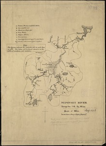
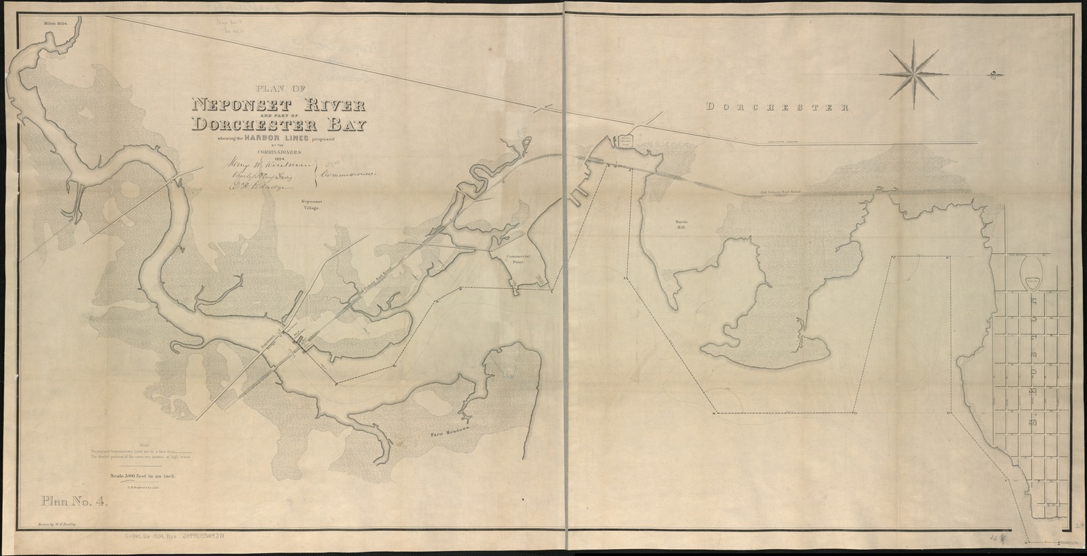
Plan of Neponset River and part of Dorchester Bay showing the harbor lines proposed by the Commissioners 1854
Item Information
- Title:
- Plan of Neponset River and part of Dorchester Bay showing the harbor lines proposed by the Commissioners 1854
- Creator:
- Bradley, W. H.
- Name on Item:
-
drawn by W.H. Bradley.
- Date:
-
[1854]
- Format:
-
Maps/Atlases
- Location:
-
Boston Public Library
Norman B. Leventhal Map & Education Center - Collection (local):
-
Norman B. Leventhal Map & Education Center Collection
- Subjects:
-
Harbors--Massachusetts--Boston--Maps
Dorchester Bay (Boston, Mass.)--Maps
Neponset River (Mass.)--Maps
Dorchester (Boston, Mass.)
- Places:
-
MassachusettsSuffolk (county)Dorchester Bay
MassachusettsNeponset (river)
- Extent:
- 1 map ; 63 x 124 cm.
- Terms of Use:
-
No known copyright restrictions.
No known restrictions on use.
- Publisher:
-
Boston :
s.n.
- Scale:
-
Scale 1:6,000.
- Language:
-
English
- Notes:
-
Oriented with north to the right.
"Plan No. 4."
- Notes (date):
-
This date is inferred.
- Identifier:
-
06_01_005012
- Call #:
-
G3762.D6 1854 .B6x
- Barcode:
-
39999059009371