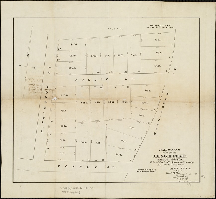
Plan of land belonging to J.M. & G.H. Pike : ward 16 - Boston
Item Information
- Title:
- Plan of land belonging to J.M. & G.H. Pike : ward 16 - Boston
- Name on Item:
-
Wm. A. Garbett.
- Date:
-
1872
- Format:
-
Maps/Atlases
- Location:
-
Boston Public Library
Norman B. Leventhal Map & Education Center - Collection (local):
-
Norman B. Leventhal Map & Education Center Collection
- Subjects:
-
Real property--Massachusetts--Boston--Maps
Land tenure--Massachusetts--Boston--Maps
Dorchester (Boston, Mass.)
- Places:
-
MassachusettsSuffolk (county)BostonDorchester
- Extent:
- 1 plan ; 38 x 43 cm.
- Terms of Use:
-
No known copyright restrictions.
No known restrictions on use.
- Publisher:
-
Boston, Mass :
[Engineering Dept.]
- Scale:
-
Scale 1:480.
- Language:
-
English
- Notes:
-
Oriented with north toward the upper right.
"To be sold at public auction on Wednesday May 22nd at 4 o'clock p.m. by Robert Vose Jr."
- Identifier:
-
06_01_003980
- Call #:
-
G3764.B6:2D6G46 1872 .G3x
- Barcode:
-
39999059003317


![[Plan of house lots for sale on Savin Hill Avenue, Dorchester, Mass.]](https://bpldcassets.blob.core.windows.net/derivatives/images/commonwealth:9s161f68b/image_thumbnail_300.jpg)

