Toggle navigation
LMEC Home
Exhibitions
Georeferencing
Tools for Teachers
Collections
My Favorites
Sign Up / Log In
Search
Search the map portal
Map Collection
Map Collection
Map Sets
Search
Search
Search for
Search In
All Fields
Creator
Title
Subject
Place
Search All Digital Collections
Advanced Search
8695 Results
My Search
Start Over
More Like
commonwealth:0z709982j
Remove constraint More Like: commonwealth:0z709982j
Filter your Search
Place
North and Central America
5,926
United States
4,843
Massachusetts
2,078
Europe
1,396
Suffolk (county)
1,045
Boston
1,018
Canada
449
Asia
438
more
Place
»
Topic
Boston (Mass.)--Maps
586
United States--Maps
282
Real property--Massachusetts--Boston--Maps
175
Massachusetts--Maps
162
Landowners--Massachusetts--Boston--Maps
133
North America--Maps--Early works to 1800
103
New England--Maps
102
Europe--Maps
79
more
Topic
»
Date
Date range begin
–
Date range end
Current results range from
1482
to
2023
View distribution
Creator
United States. Hydrographic Office
594
O.H. Bailey & Co
148
Des Barres, Joseph F. W. (Joseph Frederick Wallet), 1722-1824
123
United States. Post Office Dept
120
Ptolemy, 2nd cent
100
Walling, Henry Francis, 1825-1888
94
Geological Survey (U.S.)
86
Jefferys, Thomas, -1771
85
more
Creator
»
Format
Maps/Atlases
8,635
Manuscripts
215
Prints
56
Books
36
Objects/Artifacts
10
Drawings/Illustrations
8
Posters
5
Georeferenced
Yes
869
No
7,826
Collection
Norman B. Leventhal Map & Education Center Collection
8,693
Boston and New England Maps
2,232
Urban Maps
2,023
Maritime Charts and Atlases
1,082
American Revolutionary War-Era Maps
617
Boston Redevelopment Authority Collection
87
William L. Clements Library Collection
2
Available to use
No known restrictions
8,551
Creative Commons license
47
Search Constraints
Sort by relevance
relevance
title
date (asc)
date (desc)
Number of results to display per page
20 per page
10
per page
20
per page
50
per page
100
per page
View results as:
grid view
map view
Search Results
1.
West Indies, Haiti or Santo Domingo, Cayes, Flamand, St. Louis and Meste Bays : from French government surveys to 1872, with...
2.
West Indies, ports on the north west coast of Haiti : from the most recent surveys
3.
West Indies, ports on the south and west coasts of Haiti : from the most recent surveys
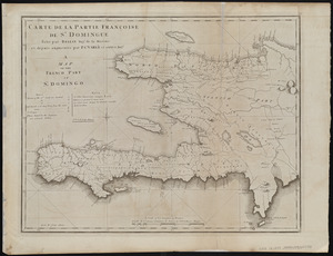
4.
Carte de la partie Françoise de St. Domingue = A map of the French part of St. Domingo
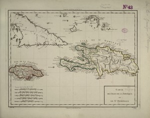
5.
Carte des isles de la Jamaïque et de St. Domingue
6.
Haiti
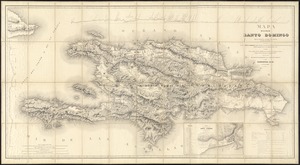
7.
Mapa de la isla de Santo Domingo
8.
Tactical pilotage chart, TPC
9.
West Indies, eastern part of Bahama Islands with part of Cuba and north coast of Santo Domingo : compiled from the latest...
10.
West Indies, eastern part of Bahama Islands with part of Cuba and north coast of Santo Domingo : compiled from the latest...
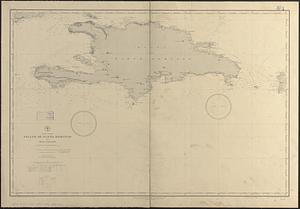
11.
West Indies, Island of Santo Domingo with Mona Passage : compiled from the latest British and Spanish charts, 1886
12.
West Indies, sheet no. Jamaica with Pedro and Rosalind Banks and with parts of Cuba and San Domingo : from British, Spanish and...
13.
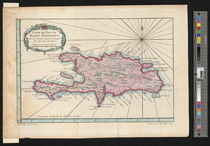
Carte de l'Isle de Saint Domingue : pour servir a l'Histoire générale des voyages
14.
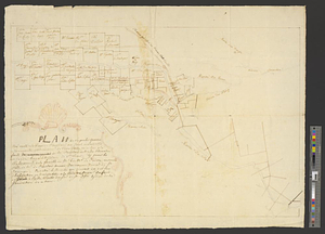
Plan du superbe quartier neuf appellé le Bays de Coustard ou sont representées les nouvelles distributions de terre faitts en...
15.
The 100th anniversary map of Abraham Lincoln's visit to Massachusetts, September 11-23, 1848
16.
1630 shoreline
17.
1879. Progress map of the U.S. Geographical Surveys west of the 100th Meridian : prepared under the direction of 1st Lieut....
18.
1903 Map of Salem and surrounding places
19.
19th annual convention of the National Association of Real Estate Boards : at Tulsa, June 7 to June 11 in 1926
20.
2005 significant U.S. hurricane strikes
‹ Prev
Next ›
1
2
3
4
5
…
434
435