Toggle navigation
LMEC Home
Exhibitions
Georeferencing
Tools for Teachers
Collections
My Favorites
Sign Up / Log In
Search
Search the map portal
Map Collection
Map Collection
Map Sets
Search
Search
Search for
Search In
All Fields
Creator
Title
Subject
Place
Search All Digital Collections
Advanced Search
8653 Results
My Search
Start Over
More Like
commonwealth:0z709377f
Remove constraint More Like: commonwealth:0z709377f
Filter your Search
Place
North and Central America
5,892
United States
4,810
Massachusetts
2,068
Europe
1,392
Suffolk (county)
1,041
Boston
1,014
Canada
451
Asia
437
more
Place
»
Topic
Boston (Mass.)--Maps
582
United States--Maps
279
Real property--Massachusetts--Boston--Maps
175
Massachusetts--Maps
161
Landowners--Massachusetts--Boston--Maps
133
North America--Maps--Early works to 1800
103
New England--Maps
101
Europe--Maps
79
more
Topic
»
Date
Date range begin
–
Date range end
Current results range from
1482
to
2023
View distribution
Creator
United States. Hydrographic Office
595
O.H. Bailey & Co
148
Des Barres, Joseph F. W. (Joseph Frederick Wallet), 1722-1824
123
United States. Post Office Dept
120
Ptolemy, 2nd cent
100
Walling, Henry Francis, 1825-1888
94
Geological Survey (U.S.)
86
Jefferys, Thomas, -1771
85
more
Creator
»
Format
Maps/Atlases
8,593
Manuscripts
215
Prints
56
Books
36
Objects/Artifacts
10
Drawings/Illustrations
8
Posters
5
Georeferenced
Yes
869
No
7,784
Collection
Norman B. Leventhal Map & Education Center Collection
8,646
Boston and New England Maps
2,221
Urban Maps
1,992
Maritime Charts and Atlases
1,083
American Revolutionary War-Era Maps
622
Boston Redevelopment Authority Collection
87
William L. Clements Library Collection
6
New-York Historical Society Collection
1
Available to use
No known restrictions
8,505
Creative Commons license
47
Search Constraints
Sort by relevance
relevance
title
date (asc)
date (desc)
Number of results to display per page
20 per page
10
per page
20
per page
50
per page
100
per page
View results as:
grid view
map view
Search Results
1.
Buffalo Harbor and head of Niagara River
2.
The Matthews-Northrup up-to-date map of Buffalo and towns of Tonawanda, Amherst, Cheektowaga and West Seneca
3.
The Matthews-Northrup up-to-date map of Buffalo and Towns of Tonawanda, Amherst, Cheektowaga and West Seneca
4.
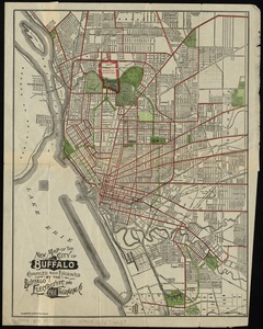
New map of the City of Buffalo
5.
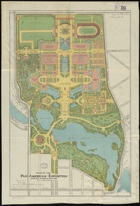
Plan of the Pan-American Exposition to be held at Buffalo, New York, May 1-Nov 1, 1901
6.
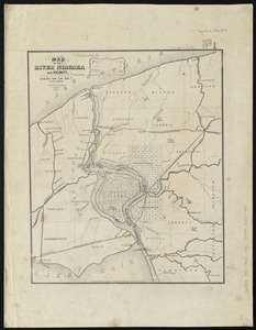
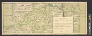
Map of the River Niagara and vicinity
7.
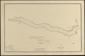
Niagara 1819
8.
Map of Niagara River or streights between the lakes Erie and Ontario with the islands, falls, and rapids therein, as also the...
9.
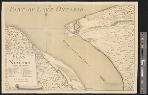
Plan of Niagara
10.
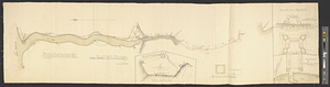
Plan of Niagara River between the Lakes Ontario and Erie
11.
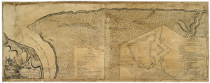
Plan of Niagara with the adjacent country surrendered to the English army under the command of Sr. Willm: Johnson Bart: on the...
12.
Plan of the road and river between Niagara and fort Schlosser with the different posts erected on the communication, by order...
13.
Sketch of the country from Fort Du Quesne to Niagara as described by an intelligent Indian who had resided there for a...
14.
A sketch of the south shore of Lake Ontario between Oswego and Niagara, and from thence up the river to aboute two miles above...
15.
The 100th anniversary map of Abraham Lincoln's visit to Massachusetts, September 11-23, 1848
16.
1630 shoreline
17.
1879. Progress map of the U.S. Geographical Surveys west of the 100th Meridian : prepared under the direction of 1st Lieut....
18.
1903 Map of Salem and surrounding places
19.
19th annual convention of the National Association of Real Estate Boards : at Tulsa, June 7 to June 11 in 1926
20.
2005 significant U.S. hurricane strikes
‹ Prev
Next ›
1
2
3
4
5
…
432
433