Toggle navigation
LMEC Home
Exhibitions
Georeferencing
Tools for Teachers
Collections
My Favorites
Sign Up / Log In
Search
Search the map portal
Map Collection
Map Collection
Map Sets
Search
Search
Search for
Search In
All Fields
Creator
Title
Subject
Place
Search All Digital Collections
Advanced Search
14 Results
My Search
Start Over
More Like
commonwealth:jm21b849z
Remove constraint More Like: commonwealth:jm21b849z
Place
South Carolina
Remove constraint Place: South Carolina
Filter your Search
Place
North and Central America
14
South Carolina
[remove]
14
United States
14
North Carolina
7
Charleston (county)
3
Georgia
3
Charleston
2
Beaufort (county)
1
more
Place
»
Topic
South Carolina--Maps--Early works to 1800
8
North Carolina--Maps--Early works to 1800
7
Georgia--Maps--Early works to 1800
2
Atlantic Coast (Ga.)--Maps
1
Atlantic Coast (S.C.)--Maps
1
Charleston (S.C.)--Maps
1
Charleston (S.C.)--Maps--Early works to 1800
1
Coasts--Georgia--Maps
1
more
Topic
»
Date
Date range begin
–
Date range end
Current results range from
1757
to
1802
1757 : 1803
1757
1803
1760
1765
1770
1775
1780
1785
1790
1795
1800
Creator
Faden, William, 1749-1836
3
Robert Sayer and John Bennett (Firm)
3
Bellin, Jacques Nicolas, 1703-1772
2
Mouzon, Henry
2
Barker, W. (William), active 1795-1803
1
Bowen, Thomas, -1790
1
Carey, Mathew, 1760-1839
1
Changuion, Daniel Jean
1
more
Creator
»
Format
Maps/Atlases
14
Georeferenced
No
14
Collection
American Revolutionary War-Era Maps
14
MacLean Collection Map Library
14
Search Constraints
Sort by relevance
relevance
title
date (asc)
date (desc)
Number of results to display per page
20 per page
10
per page
20
per page
50
per page
100
per page
View results as:
grid view
map view
Search Results
1.
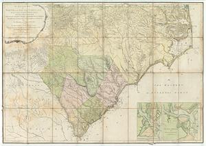
An accurate map of North and South Carolina with their Indian frontiers : shewing in a distinct manner all the mountains,...
2.
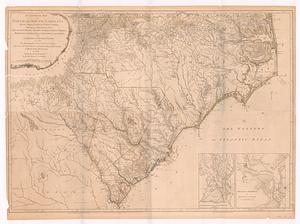
An accurate map of North and South Carolina with their Indian frontiers, shewing in a distinct manner all the mountains,...
3.
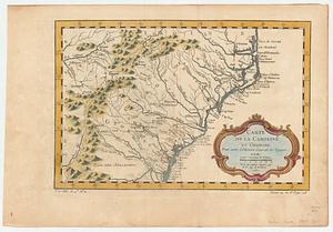
Carte de la Caroline et Georgie : pour servir à l'histoire générale des voyages
4.
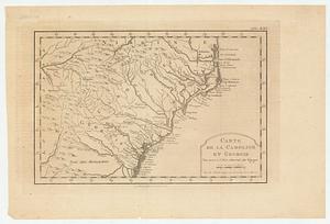
Carte de la Caroline et Georgie : pour servir à l'histoire générale des voyages
5.
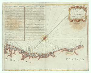
A draught of South Carolina and Georgia from Sewee to St. Estaca
6.
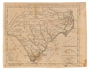
Map of North and South Carolina
7.
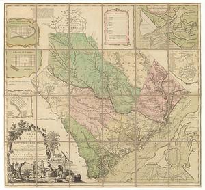
A map of the province of South Carolina with all the rivers, creeks, bays, inletts, islands, inland navigation, soundings, time...
8.
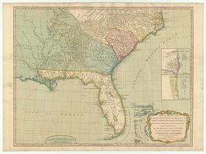
A new and general map of the southern dominions belonging to the United States of America, viz: North Carolina, South Carolina...
9.
Partie meridionale des possessions angloise en Amerique
10.
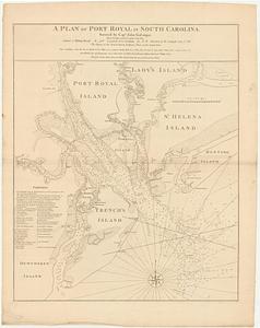
A plan of Port Royal in South Carolina
11.
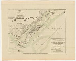
A plan of the attack of Fort Sulivan, near Charles Town in South Carolina, by a squadron of His Majesty's ships, on the 28.th...
12.
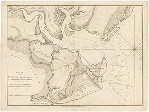
A plan of the town, bar, harbour and environs, of Charlestown in South Carolina, with all the channels, soundings,...
13.
South-Carolina and parts adjacent : shewing the movements of the American and British armies
14.
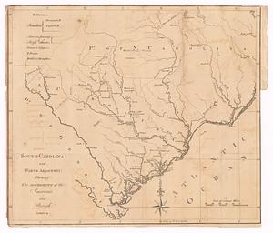
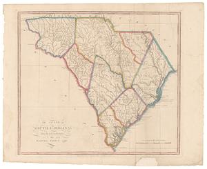
The state of South Carolina: from the best authorities
+
-
Redo search here
Search when I move the map
Leaflet
| ©
OpenStreetMap
contributors, ©
CartoDB