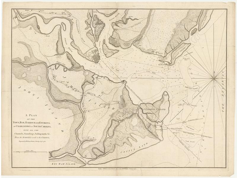
A plan of the town, bar, harbour and environs, of Charlestown in South Carolina, with all the channels, soundings, sailing-marks &c. from the surveys made in the colony
This map is also available in American Revolutionary Geographies Online (ARGO), a collections portal especially built for material relating to the American Revolutionary War Era. Visit ARGO to learn more about this item and explore the historical geography of North America in the late eighteenth century.
Item Information
- Title:
- A plan of the town, bar, harbour and environs, of Charlestown in South Carolina, with all the channels, soundings, sailing-marks &c. from the surveys made in the colony
- Engraver:
- Faden, William, 1749-1836
- Publisher:
- Faden, William, 1749-1836
- Name on Item:
-
engraved by William Faden, Charing Cross
- Date:
-
June 1, 1780
- Format:
-
Maps/Atlases
- Location:
- MacLean Collection Map Library
- Collection (local):
-
MacLean Collection Map Library
- Subjects:
-
Navigation--South Carolina--Charleston
Harbors--South Carolina--Charleston--Maps
Charleston (S.C.)--Maps
- Places:
-
South CarolinaCharleston (county)Charleston
- Extent:
- 1 map ; 506 x 681 mm
- Terms of Use:
-
Public Domain/No known restrictions on use. Contact host institution to download image.
Contact host institution for more information.
- Publisher:
-
London :
W.m Faden, Charing Cross
- Edition:
- First state
- Language:
-
English
- Identifier:
-
MC_988
- Call #:
-
988


