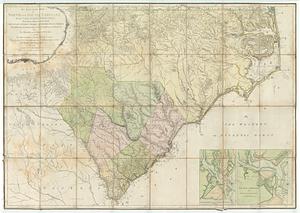
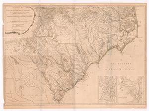
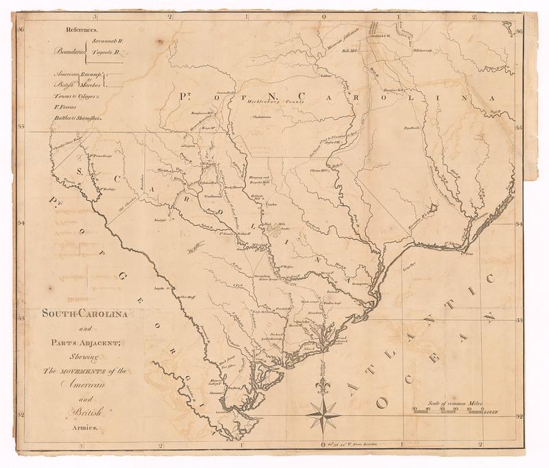
South-Carolina and parts adjacent : shewing the movements of the American and British armies
This map is also available in American Revolutionary Geographies Online (ARGO), a collections portal especially built for material relating to the American Revolutionary War Era. Visit ARGO to learn more about this item and explore the historical geography of North America in the late eighteenth century.
Item Information
- Title:
- South-Carolina and parts adjacent : shewing the movements of the American and British armies
- Publisher:
- Ramsay, David, 1749-1815
- Date:
-
[1785]
- Format:
-
Maps/Atlases
- Location:
- MacLean Collection Map Library
- Collection (local):
-
MacLean Collection Map Library
- Subjects:
-
South Carolina--Maps--Early works to 1800
North Carolina--Maps--Early works to 1800
- Places:
-
North Carolina
South Carolina
- Extent:
- 1 map ; 495 x 575 mm
- Terms of Use:
-
Public Domain/No known restrictions on use. Contact host institution to download image.
Contact host institution for more information.
- Publisher:
-
Trenton :
Ramsay, David
- Edition:
- First state
- Language:
-
English
- Notes (date):
-
This date is inferred.
- Identifier:
-
MC_13155
- Call #:
-
13155