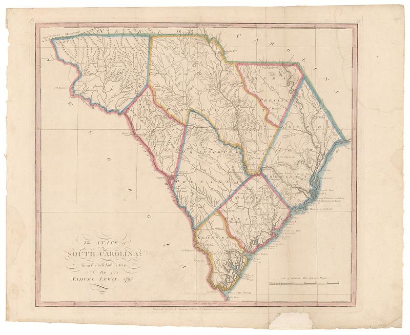
The state of South Carolina: from the best authorities
This map is also available in American Revolutionary Geographies Online (ARGO), a collections portal especially built for material relating to the American Revolutionary War Era. Visit ARGO to learn more about this item and explore the historical geography of North America in the late eighteenth century.
Item Information
- Title:
- The state of South Carolina: from the best authorities
- Creator:
- Lewis, Samuel, 1753 or 1754-1822
- Contributor:
- Barker, W. (William), active 1795-1803
- Publisher:
- Carey, Mathew, 1760-1839
- Name on Item:
-
by Samuel Lewis ; W. Barker sculp.
- Date:
-
[1802]
- Format:
-
Maps/Atlases
- Location:
- MacLean Collection Map Library
- Collection (local):
-
MacLean Collection Map Library
- Subjects:
-
South Carolina--Maps
- Places:
-
South Carolina
- Extent:
- 1 map ; 390 x 445 mm
- Terms of Use:
-
Public Domain/No known restrictions on use. Contact host institution to download image.
Contact host institution for more information.
- Publisher:
-
Philadelphia :
Carey, Mathew
- Language:
-
English
- Notes:
-
"Engraved for Carey's American edition of Guthrie's geography improved."
"38."
- Notes (date):
-
This date is inferred.
- Identifier:
-
MC_2872
- Call #:
-
2872