Toggle navigation
LMEC Home
Exhibitions
Georeferencing
Tools for Teachers
Collections
My Favorites
Sign Up / Log In
Search
Search the map portal
Map Collection
Map Collection
Map Sets
Search
Search
Search for
Search In
All Fields
Creator
Title
Subject
Place
Search All Digital Collections
Advanced Search
112 Results
My Search
Start Over
More Like
commonwealth-oai:g158gg641
Remove constraint More Like: commonwealth-oai:g158gg641
Place
Quebec
Remove constraint Place: Quebec
Filter your Search
Place
Canada
112
North and Central America
112
Quebec
[remove]
112
Saint Lawrence River
41
Québec
23
United States
18
Sept Iles
13
Chaudière, Rivière
12
more
Place
»
Topic
United States--History--French and Indian War, 1754-1763--Maps
69
Saint Lawrence River--Maps
41
Québec (Québec)--Maps
20
Sept-Iles (Québec)--Maps
13
Chaudière River (Québec)--Maps
12
Longue-Pointe (Québec)--Maps
12
Mingan Islands (Québec)--Maps
12
Saguenay River (Québec)--Maps
12
more
Topic
»
Date
Date range begin
–
Date range end
Current results range from
1744
to
1900
1744 : 1901
1744
1901
View distribution
Creator
Jefferys, Thomas, -1771
14
Cook, James, 1728-1779
12
Desjardins, pilot of Québec
12
Holland, Samuel, 1728-1801
12
Robert Sayer and John Bennett (Firm)
12
Saunders, Charles, Sir, 1713?-1775
12
Montrésor, John, 1736-1799
8
Haldimand, Frederick, Sir, 1718-1791
5
more
Creator
»
Format
Maps/Atlases
111
Documents
1
Georeferenced
No
112
Collection
American Revolutionary War-Era Maps
111
William L. Clements Library Collection
110
MacLean Collection Map Library
1
Norman B. Leventhal Map & Education Center Collection
1
Available to use
No known restrictions
1
Search Constraints
Sort by relevance
relevance
title
date (asc)
date (desc)
Number of results to display per page
20 per page
10
per page
20
per page
50
per page
100
per page
View results as:
grid view
map view
Search Results
1.
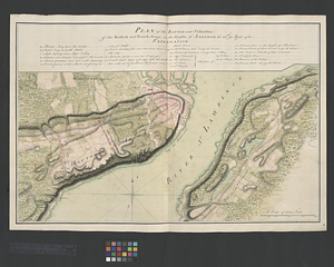
A correct plan of the environs of Quebec, and of the battle fought on the 13th September, 1759 : together with a particular...
2.
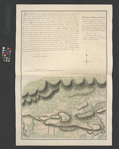
Parish of Charlebourgh
3.
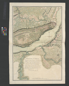
Parish of St. Foix
4.
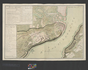
Plan of Québec with the positions of the British and French army's on the Heights of Abraham 13th of Sept. 1759 : repetition...
5.
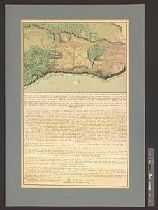
A plan of the river St. Laurence, from Sillery to the fall of Montmerenci, with the operations of the siege of Quebec; under...
6.
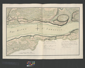
The St. Lawrence River from the Rapids of Richelieu to Cape Torment
7.
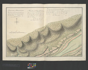
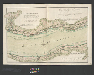
Parish of Beauport. Parish of L'Ange Gardien. Parish of Chateau Richer
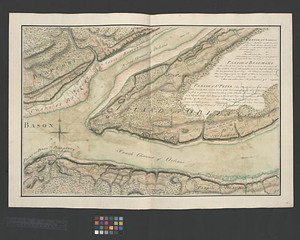
8.
Parish of St. Lawrence. Parish of Beaumont. Parish of St. Peter
9.
Parish of St. Nicholas. The Parish of St. Augustin
10.
Parish of the Ecureuils. Parish of Point aux Trembles. Parish of St. Antoine. Parish of St. Croix
11.
A new and accurate map of the English empire in North America : representing their rightful claim as confirm'd by charters, and...
12.
Plan of Québec and the Heights of Abraham, shewing in particular the French encampment after the battle of the 28th: April,...
13.
Plan of the battle and situation of the British and French armys on the Heights of Abraham the 28th: of April 1760 : repetition...
14.
Plan of the battle fought the 28th of April 1760 upon the Height of Abraham near Quebec between the British troops garrisoned...
15.
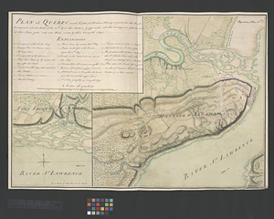
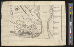
Plan de la ville de Québec
16.
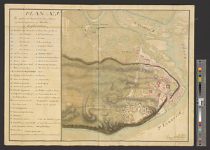
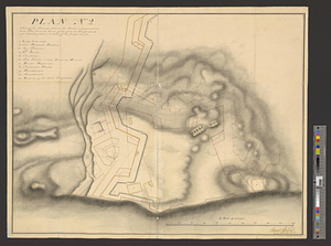
Plan (no. 1) To explain the report of the state of defence of the fortifications of Quebec
17.
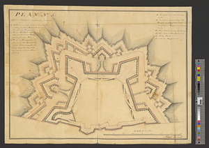
Plan (no. 2) shewing the ground whereon the citadel is proposed to be built : the ground lines of the present fortifications...
18.
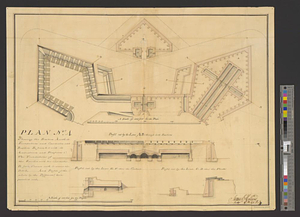
Plan (no. 3) of the citadel compleatly finished
19.
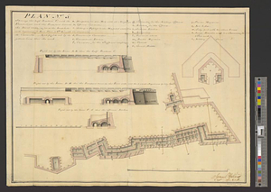
Plan no. 4 shewing the bastion A with its foundations and casemates and bastion B finish'd with its ambrazures and platforms C...
20.
Plan (no. 5) shewing the half bastion C with its foundations and the rampart towards the river side, as far as the loop-hole...
+
-
Redo search here
Search when I move the map
Leaflet
| ©
OpenStreetMap
contributors, ©
CartoDB
‹ Prev
Next ›
1
2
3
4
5
6