Toggle navigation
LMEC Home
Exhibitions
Georeferencing
Tools for Teachers
Collections
My Favorites
Sign Up / Log In
Search
Search the map portal
Map Collection
Map Collection
Map Sets
Search
Search
Search for
Search In
All Fields
Creator
Title
Subject
Place
Search All Digital Collections
Advanced Search
41 Results
My Search
Start Over
More Like
commonwealth:q524ng40z
Remove constraint More Like: commonwealth:q524ng40z
Place
New York
Remove constraint Place: New York
Filter your Search
Place
New York
[remove]
41
North and Central America
41
United States
30
Manhattan
7
New Jersey
6
Bronx
5
Bergen (county)
3
Brooklyn (borough)
2
more
Place
»
Topic
Fortification--New York (State)--New York--Maps--Early works to 1800
10
New York (N.Y.)--Buildings, structures, etc--Maps, Manuscript--Early works to 1800
8
New York (N.Y.)--Maps, Manuscript--Early works to 1800
8
Manhattan (New York, N.Y.)--Maps, Manuscript--Early works to 1800
6
Manuscript maps--Early works to 1800
4
New Jersey--Maps, Manuscript--Early works to 1800
4
New York (State)--Maps, Manuscript--Early works to 1800
4
Kingsbridge (New York, N.Y.)--Buildings, structures, etc--Maps, Manuscript--Early works to 1800
3
more
Topic
»
Date
Date range begin
–
Date range end
Current results range from
1750
to
1793
1750 : 1794
1750
1794
View distribution
Creator
Montrésor, John, 1736-1799
5
Sauthier, Claude Joseph
4
Bancker, Gerard, 1740-1799
1
Collins, John, -1795
1
De Lancey, Oliver, 1752-1822
1
Durnford, Desmaretz, -1782
1
Millidge, Thomas
1
Porter, William B.
1
more
Creator
»
Format
Manuscripts
41
Maps/Atlases
41
Georeferenced
Yes
1
No
40
Collection
American Revolutionary War-Era Maps
41
Library of Congress Collection
40
Newberry Library Collection
1
Available to use
Creative Commons license
40
Search Constraints
Sort by relevance
relevance
title
date (asc)
date (desc)
Number of results to display per page
20 per page
10
per page
20
per page
50
per page
100
per page
View results as:
grid view
map view
Search Results
1.
Lines run in the Jersies for determining boundaries between that Province & New York
2.
A plan of the division line between the provinces of New-York and Quebec : In the 45th degree of north latitude. Survey'd in...
3.
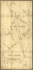
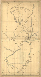
The State of New Jersey
4.
Carte d'un partie de l'Amerique Septentrionale : ou est tracée notre route d'Halifax à New York, par Quebec, Montreal, le Lac...
5.
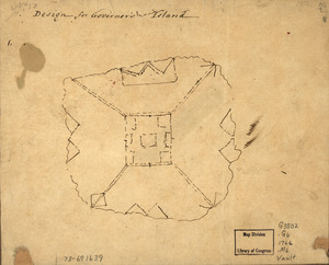
Design for Governor's Island
6.
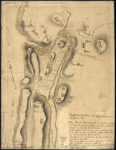
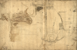
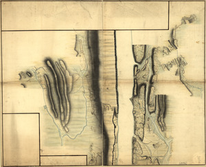
Disposition of British troops, with fortifications north of Fort Knipehausen, i.e. Fort Washington to Fort Independence
7.
A map containing part of the Provinces of New York and New Jersey
8.
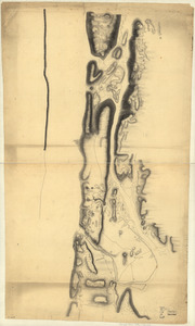
Map of defenses of New York Island from Fort Washington to Fort Independence, with redoubts, etc. planned between
9.
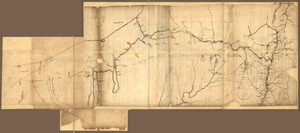
Map of Gen. Sullivan's march from Easton to the Senaca & Cayuga countries
10.
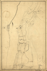
A map of part of New-York Island showing a plan of Fort Washington : now call'd Ft. Kniphausen with the rebels lines on the...
11.
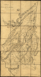
Map of the northern parts of New York
12.
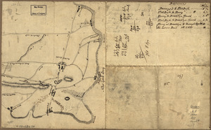
Map showing the Bowery Lane area of Manhattan
13.
Marche de l'armée française de Providence à la Rivière du Nord
14.
New York & New Jersey commissioners line from 41⁰ on Hudson's River taken in 1769
15.
New York Island : Military; unfinished
16.
New York Island and East Jersey : Unfinished
17.
New York Island. Military. Unfinished
18.
Nord de l'Ile de New-York
19.
N.W. parts of New York, no. 156
20.
Old map of Brooklyn and greater part of King's County, Long Island
‹ Prev
Next ›
1
2
3