Toggle navigation
LMEC Home
Exhibitions
Georeferencing
Tools for Teachers
Collections
My Favorites
Sign Up / Log In
Search
Search the map portal
Map Collection
Map Collection
Map Sets
Search
Search
Search for
Search In
All Fields
Creator
Title
Subject
Place
Search All Digital Collections
Advanced Search
20 Results
My Search
Start Over
More Like
commonwealth-oai:cn69r351f
Remove constraint More Like: commonwealth-oai:cn69r351f
Topic
Louisbourg (N.S.)--Maps
Remove constraint Topic: Louisbourg (N.S.)--Maps
Filter your Search
Place
Canada
20
Louisbourg
20
North and Central America
20
Nova Scotia
20
Annapolis Royal
1
Atlantic Ocean
1
Eastern United States
1
Fort Beauséjour National Historic Park
1
more
Place
»
Topic
Louisbourg (N.S.)--Maps
[remove]
20
United States--History--French and Indian War, 1754-1763--Maps
11
Louisbourg (N.S.)--History--Siege, 1758--Maps
5
United States--History--King George's War, 1744-1748--Maps
3
Annapolis Royal (N.S.)--Maps
1
Atlantic Ocean--Maps
1
Canada, Eastern--Maps
1
East (U.S.)--Maps
1
more
Topic
»
Date
Date range begin
–
Date range end
Current results range from
1740
to
1767
1740 : 1768
1740
1768
View distribution
Creator
Bastide, John Henry, approximately 1700-1770
3
Sproule, Geo. F. (George F.), 1741-1817
3
Bontein, William
1
Coltz, C., cartographer
1
Coombs, Richard
1
Durell, Phillip
1
Herbert, William, 1718-1795
1
Holland, Samuel, 1728-1801
1
more
Creator
»
Format
Maps/Atlases
20
Georeferenced
No
20
Collection
American Revolutionary War-Era Maps
20
William L. Clements Library Collection
20
Search Constraints
Sort by relevance
relevance
title
date (asc)
date (desc)
Number of results to display per page
20 per page
10
per page
20
per page
50
per page
100
per page
View results as:
grid view
map view
Search Results
1.
Gabarus Bay
2.
Louisbourg, latitude 45⁰ 50' north
3.
Map of the British landings at Louisbourg
4.
Map of the coast of Cape Breton from Fort William to Louisbourg
5.
A new and accurate map of the English empire in North America : representing their rightful claim as confirm'd by charters, and...
6.
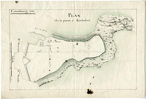
Plan de la pointe à Rochefort
7.
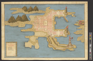
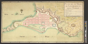
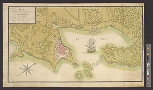
Plan de la ville de Louisbourg à l'Isle Royale
8.
Plan du port et de la ville de Louisbourg en l'Isle Royale et des attaques faites par les Anglois pandent le siege depuis le 8...
9.
Plan du port et de la ville de Louisbourg en l'Isle Royale, et des Attaques faites par les Anglois pendant le Siége depuis le 8...
10.
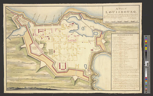
A plan of Louisbourg : intended only to shew by strong red the publick buildings lately erected; and by the faint red such as...
11.
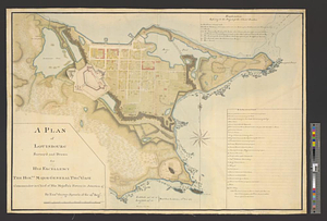
A plan of Louisbourg survey'd and drawn for his excellency the honble. Major General Thos. Gage commander in chief of his...
12.
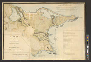
A plan of Louisbourg survey'd and drawn for his excellency the honble. Major General Thos. Gage commander in chief of his...
13.
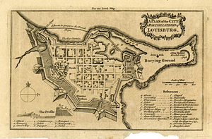
A plan of the city & fortifications of Louisbourg
14.
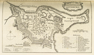
A plan of the city & fortifications of Louisbourg
15.
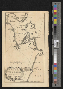
A plan of the city & harbor of Louisburg
16.
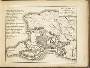
Plan of the city and fortress of Louisbourg, with the attacks
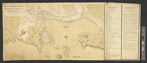
17.
Plan of the harbour and fortifications of Louisbourg : the harbour survey'd by Capt. Phillip Durell: the town and...
18.
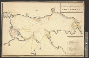
A plan of the harbour of Louisbourg with the adjacent country survey'd by Samuel Holland esqr. surveyer [sic] general for the...
19.
Plan von Fort Cumberland auf der insel St. Laurenti
20.
A survey of the city and fortress of Louisbourg, the harbour, and their environs, from Fresh Water Cove in Gabarouse Bay to...


![A plan of the harbour of Louisbourg with the adjacent country survey'd by Samuel Holland esqr. surveyer [sic] general for the northern district of North America](https://bpldcassets.blob.core.windows.net/derivatives/metadata/commonwealth-oai:fx71fk83p/image_thumbnail_300.jpg)