Toggle navigation
LMEC Home
Exhibitions
Georeferencing
Tools for Teachers
Collections
My Favorites
Sign Up / Log In
Search
Search the map portal
Map Collection
Map Collection
Map Sets
Search
Search
Search for
Search In
All Fields
Creator
Title
Subject
Place
Search All Digital Collections
Advanced Search
8552 Results
My Search
Start Over
More Like
commonwealth:4m90fm73s
Remove constraint More Like: commonwealth:4m90fm73s
Available to use
No known restrictions
Remove constraint Available to use: No known restrictions
Filter your Search
Place
North and Central America
5,811
United States
4,730
Massachusetts
2,041
Europe
1,393
Suffolk (county)
1,019
Boston
993
Canada
449
Asia
425
more
Place
»
Topic
Boston (Mass.)--Maps
574
United States--Maps
209
Real property--Massachusetts--Boston--Maps
173
Massachusetts--Maps
154
Landowners--Massachusetts--Boston--Maps
132
North America--Maps--Early works to 1800
103
New England--Maps
102
Europe--Maps
79
more
Topic
»
Date
Date range begin
–
Date range end
Current results range from
1482
to
2022
1482 : 2023
1482
2023
View distribution
Creator
United States. Hydrographic Office
595
O.H. Bailey & Co
148
Des Barres, Joseph F. W. (Joseph Frederick Wallet), 1722-1824
123
United States. Post Office Dept
120
Ptolemy, 2nd cent
100
Walling, Henry Francis, 1825-1888
94
Geological Survey (U.S.)
86
Jefferys, Thomas, -1771
84
more
Creator
»
Format
Maps/Atlases
8,492
Manuscripts
215
Prints
56
Books
35
Objects/Artifacts
10
Drawings/Illustrations
8
Posters
5
Georeferenced
Yes
836
No
7,716
Collection
Norman B. Leventhal Map & Education Center Collection
8,552
Boston and New England Maps
2,197
Urban Maps
2,008
Maritime Charts and Atlases
1,082
American Revolutionary War-Era Maps
614
Boston Redevelopment Authority Collection
87
Available to use
No known restrictions
[remove]
8,552
Search Constraints
Sort by relevance
relevance
title
date (asc)
date (desc)
Number of results to display per page
20 per page
10
per page
20
per page
50
per page
100
per page
View results as:
grid view
map view
Search Results
1.
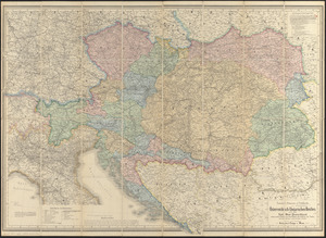
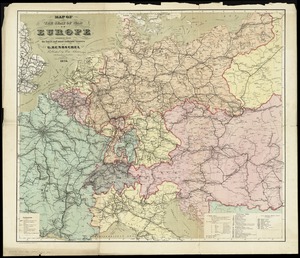
G. Freytags völker- und sprachenkarte von Österreich-Ungarn
2.
General-strassen & ortskarte des Österreichisch-Ungarischen Reiches nebst ganz süd-west-Deutschland einem grossen theile von...
3.
Turkey, in Europe and Hungary : from the best authorities
4.
The A.A.A. key road map of continental Europe
5.
Bacon's map of Central Europe
6.
Bartholomew's contour motoring map of Central Europe showing the best touring roads with heights and distances in metres and...
7.
Bradshaw's map of the railways, in Central Europe
8.
Carl Jügel's post u. reise karte von Deutschland und den nachbar staaten, bis London, Paris, Montpellier, Florenz, Warschau,...
9.
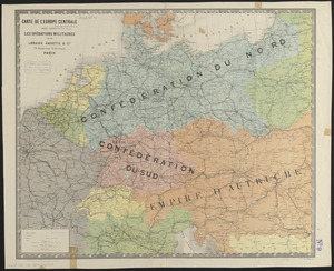
Carte de l'Europe Centrale pour suivre les opérations militaires
10.
Central Europe, 1914 : showing important fortresses and strategic points affected by the great European war
11.
The Daily Telegraph map no. 25 : races of Eastern Europe
12.
Deutschland
13.
Deutschland, königr. der Niederlande, kgr. Belgien und die Schweiz, nebst theilen der angränzenden länder nach Adolf...
14.
Deutschland und der gröste theil der umliegenden staaten oder Mittel-Europa in 35 blättern : nach astronomischen...
15.
Deutschland und der gröste theil der umliegenden staaten, oder Mittel-Europa in 35 blättern : nach astronomischen...
16.
A diagrammatic road map of Central Europe : for the use of automobilists and cyclists
17.
Germany, main movements of freight traffic, 1942
18.
Index map to the handbook for travellers on the continent
19.
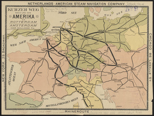
Kurzer weg nach und von Amerika via Rotterdam, Amsterdam oder Boulogne s/M
20.
Map of the seat of war in Europe compiled from the latest and most authentic sources
+
-
Redo search here
Search when I move the map
Leaflet
| ©
OpenStreetMap
contributors, ©
CartoDB
‹ Prev
Next ›
1
2
3
4
5
…
427
428