Toggle navigation
LMEC Home
Exhibitions
Georeferencing
Tools for Teachers
Collections
My Favorites
Sign Up / Log In
Search
Search the map portal
Map Collection
Map Collection
Map Sets
Search
Search
Search for
Search In
All Fields
Creator
Title
Subject
Place
Search All Digital Collections
Advanced Search
15 Results
My Search
Start Over
More Like
commonwealth:w3768q27s
Remove constraint More Like: commonwealth:w3768q27s
Creator
Robert Sayer and John Bennett (Firm)
Remove constraint Creator: Robert Sayer and John Bennett (Firm)
Filter your Search
Place
North and Central America
15
United States
8
North America
5
Canada
3
South Carolina
3
North Carolina
2
Quebec
2
Charleston
1
more
Place
»
Topic
North America--Maps--Early works to 1800
4
North Carolina--Maps--Early works to 1800
2
South Carolina--Maps--Early works to 1800
2
Atlantic Provinces--Maps--Early works to 1800
1
Banks (Oceanography)--North Atlantic Ocean--Maps--Early works to 1800
1
Charleston (S.C.)--Maps--Early works to 1800
1
Great Britain--Colonies--America--Maps--Early works to 1800
1
Indians of North America--Southern States--Maps--Early works to 1800
1
more
Topic
»
Date
Date range begin
–
Date range end
Current results range from
1775
to
1794
1775 : 1795
1775
1795
View distribution
Creator
Robert Sayer and John Bennett (Firm)
[remove]
15
Bowen, Emanuel, 1693 or 1694-1767
4
Gibson, J. (John), active 1750-1792
4
Laurie & Whittle
2
Mouzon, Henry
2
Anville, Jean Baptiste Bourguignon d', 1697-1782
1
Carver, Jonathan, 1710-1780
1
Fry, Joshua, approximately 1700-1754
1
more
Creator
»
Format
Maps/Atlases
15
Georeferenced
No
15
Collection
American Revolutionary War-Era Maps
15
MacLean Collection Map Library
14
Maps from AAS
1
Search Constraints
Sort by relevance
relevance
title
date (asc)
date (desc)
Number of results to display per page
20 per page
10
per page
20
per page
50
per page
100
per page
View results as:
grid view
map view
Search Results
1.
A New map of the whole continent of America, divided into North and South and West Indies. : With a descriptive account of the...
2.
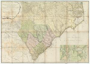
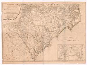
An accurate map of North and South Carolina with their Indian frontiers : shewing in a distinct manner all the mountains,...
3.
An accurate map of North and South Carolina with their Indian frontiers, shewing in a distinct manner all the mountains,...
4.
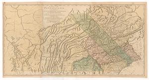
A map of Pennsylvania exhibiting not only the improved parts of that province, but also its extensive frontiers : laid down...
5.
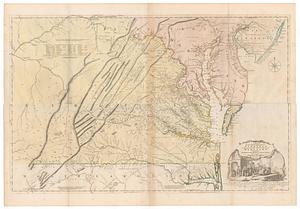
A map of the most inhabited part of Virginia containing the whole province of Maryland with part of Pensilvania, New Jersey and...
6.
A new and correct map of North America : with the West India Islands divided according to the last treaty of peace, concluded...
7.
A new and correct map of North America; with the West India Islands : divided according to the last treaty of peace, concluded...
8.
A new and correct map of North America; with the West India Islands : divided according to the preliminary articles of peace,...
9.
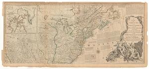
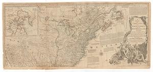
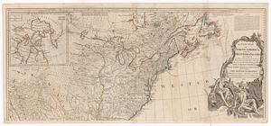
A new and correct map of the British colonies in North America : comprehending eastern Canada with the province of Quebec, New...
10.
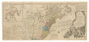
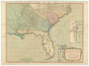
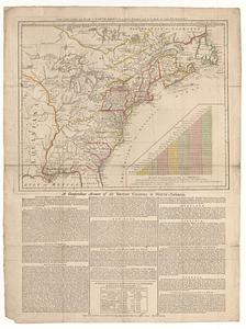
A new and general map of the southern dominions belonging to the United States of America, viz: North Carolina, South Carolina...
11.
A new map of North America; with the West India Islands : divided according to the preliminary articles of peace, signed at...
12.
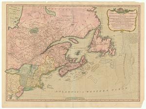
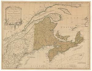
A new map of Nova Scotia, and Cape Breton Island with the adjacent parts of New England and Canada, composed from a great...
13.
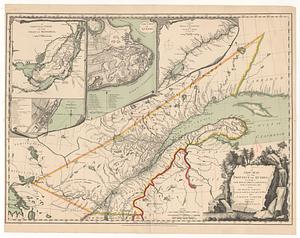
A new map of the province of Quebec, according to the royal proclamation, of the 7.th of October 1763 : from the French surveys...
14.
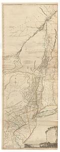
The provinces of New York, and New Jersey; with part of Pensilvania, and the governments of Trois Rivieres, and Montreal
15.
The theatre of war in North America, with the roads and a table of the distances