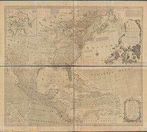
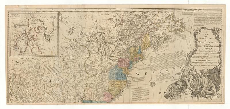
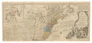
A new and correct map of North America : with the West India Islands divided according to the last treaty of peace, concluded at Paris, 10.th Feb.y 1763, wherein are particularly distinguished the several provinces and colonies which comprise the British Empire, laid down according to the latest surveys, and corrected from the original materials, of Gover.n Pownall, Mem.br of Parlia.mt 1779
This map is also available in American Revolutionary Geographies Online (ARGO), a collections portal especially built for material relating to the American Revolutionary War Era. Visit ARGO to learn more about this item and explore the historical geography of North America in the late eighteenth century.
Item Information
- Title:
- A new and correct map of North America : with the West India Islands divided according to the last treaty of peace, concluded at Paris, 10.th Feb.y 1763, wherein are particularly distinguished the several provinces and colonies which comprise the British Empire, laid down according to the latest surveys, and corrected from the original materials, of Gover.n Pownall, Mem.br of Parlia.mt 1779
- Contributor:
- Bowen, Emanuel, 1693 or 1694-1767
- Contributor:
- Gibson, J. (John), active 1750-1792
- Publisher:
- Robert Sayer and John Bennett (Firm)
- Date:
-
July 15, 1779
- Format:
-
Maps/Atlases
- Location:
- MacLean Collection Map Library
- Collection (local):
-
MacLean Collection Map Library
- Subjects:
-
North America--Maps--Early works to 1800
- Places:
-
North America (area)
- Extent:
- 2 maps ; 510 x 1164 mm and 510 x 1166 mm
- Terms of Use:
-
Public Domain/No known restrictions on use. Contact host institution to download image.
Contact host institution for more information.
- Publisher:
-
London :
Printed for Rob.t Sayer and Jn.o Bennett, n.o 53 Fleet Street
- Language:
-
English
- Identifier:
-
MC_20112
- Call #:
-
20112